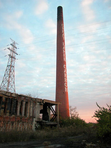
The western edge of Carondelet was disconnected by the construction of Interstate Highway 55 in 1961, and was subsequently absorbed into the Holly Hills neighborhood despite retaining strong architectural similarities with its old body. While decades of highway-traveling St. Louisans see the highway as a natural western boundary to Carondelet, the common fields of the village Carondelet stretched as far west as the road that became Grand Avenue. These fields lay largely undeveloped until Carondelet was annexed into St. Louis in 1870, and found a focal point when Carondelet Park was plotted in 1875. The area south of the park gained many of the features of old Carondelet, with hilly terrain dotted in relatively low-density frame homes and brick bungalows.
Later additions to this area built it up further with sturdy buildings, mostly one and two stories. In the early years of the 20th century, flat-roofed homes with shaped parapets were prevalent. The builders were familiar Carondelet contractors, including William and Theodore Degenhardt, whose family lumber business had ballooned into a real estate force in Carondelet at the turn of the century. By the 1920s, Spanish Revival and Craftsman bungalows filled in the remaining vacant lots. A few homes rose in the years after that on lots where very old frame homes collapsed, rotted, burned or simply fell from favor. Many of these buildings were concentrated on City Block 3026, bounded by South Grand on the west, Loughborough on the north, Blow on the south and the former Alaska Street -- later part of a Schnucks grocery store parking lot -- to the east.
That Schnucks store was a moderate intrusion in the neighborhood, but nothing like the real estate project that was proposed by the Schnucks family real estate arm, the Desco Group, in 2004. They called for tearing down their store, all of the buildings on City Block 3026 and the Nordyne plant to the south. The cleared area would become the site of a new retail development called "Loughborough Commons," containing a large Lowe’s hardware store, a new and expanded Schnucks store and other unnamed tenants. The need for the project was created through public relations, not public demand; Carondelet and Holly Hills are steady but not booming retail areas, and surely the Schnucks store was doing very well as it was. The project hinged on a lot of retail space built on speculation, too. Negotiations with Nordyne were successful, and the backing of the alderman helped convince homeowners to sell out -- or face eminent domain proceedings. One household, at 7016 S. Grand, that did refuse to leave were dragged into eminent domain proceedings that kept their home standing into December 2005. Getting approval of city board and the Board of Aldermen for the project was quite easy, and Mayor Francis Slay used the project in his 2005 re-election literature.
Demolition of Nordyne commenced in April 2005. Next came the venerable Carondelet Sunday Morning Athletic Club at 1012 Loughborugh, followed by demolition of the homes (except 7016 S. Grand) in July and August. As soon as the Nordyne land was cleared of structures, it deeply resembled a muddy no-place that was even worse than the monolithic plant that it replaced. By the end of 2005, history had been removed completely from the site. Far from looking clean, however, the cleared site looked chaotic and volatile.
Here we see another attempt by profit-driven developers to carelessly obliterate a definite geography. The modest homes, athletic club and even the Nordyne Plant were ripe with traces of history. Their comparable age, small material scale and dense placement gave the blocks along Loughborough, South Grand and Blow historic character. Each ornamental brick, old-growth tree and original front door served not only as visual stimulation for a passer-by but gave the area a series of tiny identification marks. Not only did the place consist of the city blocks, those blocks contained different lots, the lots contained buildings and the buildings encompassed thousands of little unique parts. Each house was a unique architectural creation, and most were memorable compositions. This was a place made for the casual eye of the pedestrian.
In stark contrast, the Loughborough Commons project omits strong repulsiveness. The very name is an assault on the notion of public space, despite its providing its own punch line in jokes about its plainer-than-Jane architecture. To call private, regulated space a "commons" mocks not only public willingness to participate in the robbery of their own democratic rights but also the fundamental principles of urban life. Cities create architectural space by balancing private and public spheres as well as enclosed and open space. A commercial strip mall may contain more open space than a small city park, but it does not create any space that belongs to the citizens at large. There is an admission price, so to speak, and the design is not the result of consensus or even government input. Worst of all, the space is adverse to pedestrian access -- unlike real urban commons that are vehicle-free. Loughbrough Commons consists of private stores surrounded by paved parking lots, with very skimpy sidewalk connections. The customer is expected to arrive via private vehicle and chart a sure course; casual wandering is not invited, nor is it even desirable. (Who would wander around a parking lot except a mugger or stray cat?)
The design of the strip mall buildings hardly warrants critique; they are typical functionalist boxes. The developer does not care about the design any more than I do. If the buildings themselves attracted any attention, they would overshadow the large backlit plastic signs affixed to them. Their role is the containment of space, and provide no decoration or enjoyment. The best hope that designers of such buildings have is to avoid offending any one user of these buildings. Better still would be getting the user to completely forget what the buildings looked like, since the goal is the association of the location with a particular store brand. No mix of uses is included either, because that would require greater architectural effort and would diminish the impact of the store's advertised names. Function dictates form, and form is obscured as close to the point of obliteration as possible.
The Commons project is yet another exercise in place-erasing. The design and function are purely commercial, and make no meaningful relationship with the topography, surrounding buildings or even the street grid. The strip mall faces the interstate highway, like any other. The context has not been embraced or even ignored. It has been taken at a value of zero, as if the strip mall's function in itself should be the only concern of the design. The end result is the reverse, though: the strip mall pierces the city fabric as a void, a zero-value surrounded by the strong presence of the southern part of Holly Hills. From the houses to the abundant, planned flora of Carondelet Park, this setting is a well-defined urban space. The strip mall has claimed part of the context, but visually it seems a tasteless anomaly.
If this were a chance occurrence, there would be little reason to worry greatly. The architecture of "Loughborough Commons" would discredit itself, and the public would seek to prevent another rupture of their geography. Unfortunately, though, this is just the latest trauma to attack a city whose general public has long since resigned itself to such attacks. Even in this area, the interstate highway took away some definition of place and disconnected Holly Hills from Carondelet, way back in 1961. Then came the existing Schnucks store on Loughborough, and the Nordyne expansion project. By the time THF arrived to build their project, the context here was diminished. Citywide, so much erasure of place had happened that a "what-the-heck" attitude was prevalent. Primary opposition to the project came from residents whose homes Desco took, although every last one has now settled with the threatening real estate giant on a "fair price." Eminent domain opponents who sided with residents seemed more interested in securing a fair price or defending the right to private property -- the same right that enabled THF to claim it has proper rights to build its strip mall -- than in defending the right of citizens to place. Enough place still existed here that its preservation would have been greatly beneficial to the social fabric of the neighborhood.

 UPDATE Monday, March 22 at 7:21 p.m.: The Preservation Board voted to uphold staff denials for both 414-18 N. Boyle and 6102 Michigan.
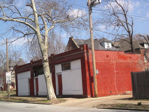 The little row was built behind a large house that once stood facing Westminster. The first section was a small one-room brick carpenter's shop built at the alley in 1910; the row expanded at some point in the next decade. The Maryland Avenue streetcar line went north along Boyle to connect to the Olive Street line; this little backyard was too valuable not to build up. In fact, the owner of the house to the south built a similar row at 408-10-12 N. Boyle across the alley -- now long gone.