
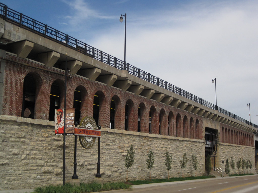
The southern flank of the mighty Eads Bridge has received a major landscape upgrade, due to the efforts of Metro, the Jefferson National Expansion Memorial and the Laclede's Landing Redevelopment Corporation. That is to say, the strip between the bridge approach and Washington Avenue actually now is landscaped! The difference between the formerly part-mulch, part-dirt terrain and the new verdant tree-planted, grassy, flowery setting could not be more stark.
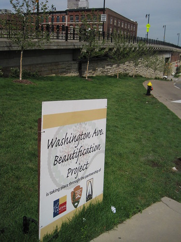 For years, this area was a disgraceful disarray in an area marred by many such urban design problems, including the intrusive elevated section of I-70, the parking garage barrier on the northern edge of the Memorial and the lackluster riverfront itself. The "Washington Avenue Beautification Project" does not resolve these larger issues, but vanquishes the terrible appearance of a very-visible area. Pedestrians on the Eads Bridge can now look out at the Gateway Arch and grounds, and look down and see an extension of that inviting park setting.
I do have a quibble with the project concerning the lack of sidewalk on most of this side of Washington. (The other side of the street has a continuous sidewalk.) The photograph on the left shows the sidewalk running east from Second Street to First Street, while that on the right shows the strip running west.
 |  |
Addition of metered parking here -- something that Metro, operator of the garage, would likely oppose -- would be desirable. Meters would relieve parking problems on the Landing and calm traffic. However, a continuous sidewalk would be needed. Perhaps this issue can be explored in any design competition that the National Park Service (NPS) undertakes for the Memorial. NPS' draft general management plan for the Memorial identifies the parking garage site as potentially worth repurposing, so this corridor could be transformed at some point.
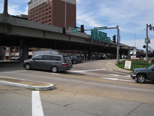 Of course, the sidewalk would lead westward walkers out into the morass of the Eads Bridge/Memorial Drive/Washington Avenue intersection. This intersection may be the most confusing in the city! Hopefully any design competition will lead to resolution of this problem, which plagues one of the Memorial's key entry points. Removal of the interstate is the most direct way to clarify traffic issues here, but that removal is probably on a slower track than the design competition timeline. Who knows? Perhaps the design competition will be the impetus for grad civic thinking on urban design, and our political leaders will embrace a visionary change downtown like those who laid out the Memorial did so long ago.
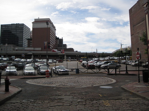
For now, the most-traveled pedestrian path between downtown and the Landing is right here. Can't see the path? Well, look carefully. There is a gate-sized opening in the fence of this parking lot on Second Street. People walk back and forth across this lot all day long, because it remains the most direct link between the Landing and downtown. It does not require much imagination to recognize that there is a major connectivity issue here. A sidewalk on Washington would have helped, although the larger disconnect between the riverfront and downtown remains the big problem.
The Washington Avenue Beautification Project points the way to a realistic way to implement changes to the riverfront that will add up to transformative action. While we need visionary leadership on the riverfront design challenge, we also need resolution of glaring quality of experience problems whose resolution is obvious. This space on Washington needed landscaping, and now it is landscaped. Laclede's Landing needs a better pedestrian connection to downtown. Perhaps a sidewalk on the north side of Washington is the way to go -- narrow the street, build a sidewalk along the new plantings. Perhaps the path already being used could be formalized through reconstruction of Lucas Avenue west through the parking lot. Let's follow one change with another and keep the momentum rolling.


1 comment:
I agree, Washington Avenue looks so much nicer now and people are actually walking on the sidewalk up to the intersection area (instead of in the right lane of the roadway, as before). I, too, scratched my head about the partial sidewalk decision, but I suppose since there is one across the street they figure that's good enough. The crossing up through that parking lot is a nasty mess, as is the intersection under the interstate. I've always wondered what tourists think when they come down to the Landing and then have to cross there to get back to the downtown area.
Post a Comment