We've Moved

Ecology of Absence now resides at www.preservationresearch.com. Please change your links and feeds.

Showing posts with label land use. Show all posts

Wednesday, March 11, 2009

Dead Zone

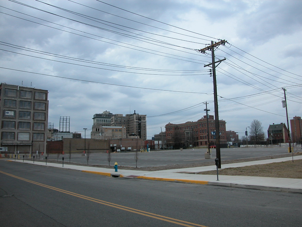
Over the weekend, I had the opportunity to spend some time at the site on Locust Street where the livery stable demolished by St. Louis University in 2007 once stood. The site would be located at the northwest corner of Locust and Josephine Baker Avenue, except that the university requested that Josephine Baker be removed.

The occasion was the filming of This Was the Future, a short documentary on the efforts to save the DeVille Motor Hotel (more on that film later). For the film, interview subjects were invited to select a site where a historic building once stood that is now an empty hole in a vibrant area. While it is hard to choose from some of the harsh empty lots we have in this city, I settled on what has to be one of the worst urban planning disasters in recent years.

The two-story livery stable building was a bridge between the emergent renewal in the Locust Street Business District and the more established revitalization of Grand Center. Grand Center's motto is "the intersection of art and life," an acknowledgment of the power of crossroads. Here stood a building that was a crossroads, and now we have an asphalt chasm, and not even a literal crossroads since one of the two streets here is now gone.

Even as a warehouse, the livery stable exuded more life than the parking lot on a busy night. On a Saturday afternoon, not a single car was parked on the lot, and few were parked at nearby meters. Clearly, the lot is there for special events. However, trading the potential of daily urban activity in a rehabilitated building for the occasional overuse of a parking lot makes no sense in a central city location. Not at all.

The side effect of the livery stable debacle is the spatial segregation (through building density) of Grand Center from the emergent area on Locust and of Renaissance Place (through removal of Josephine Baker) from St. Louis University and Locust Street. Human-scale urban renewal has finally come to Midtown on Locust Street and at Renaissance Place, and a potential connection between those successes is lost, and replaced with a land use that not only divides but is totally alien to the surrounding urban fabric. We could have done so much better.

Tuesday, October 28, 2008

The Churches of Pruitt-Igoe

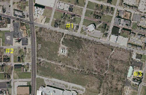
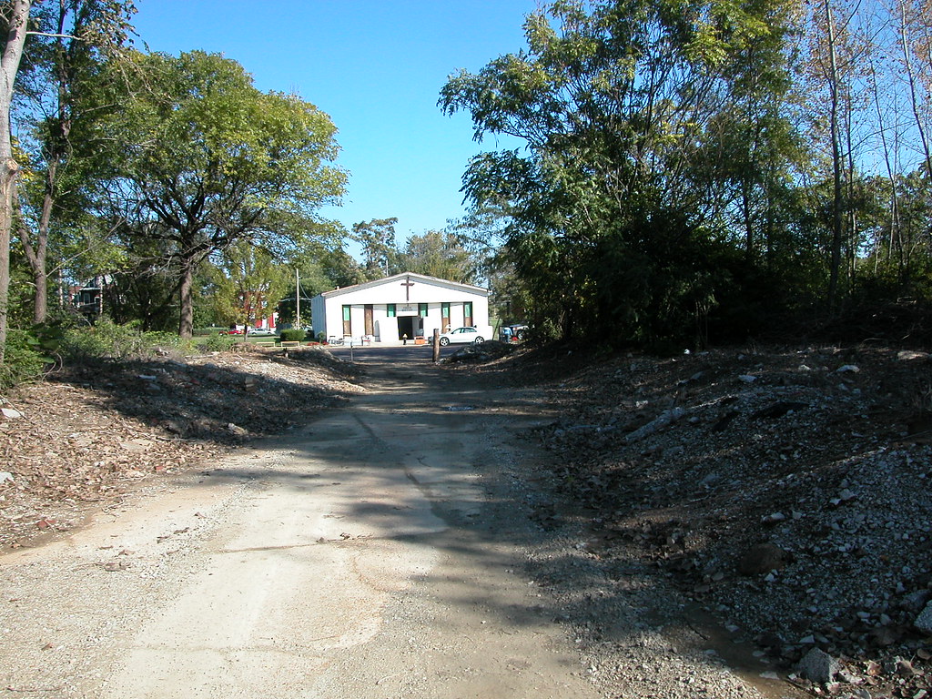
In the center of the Pruitt-Igoe Nature Preserve, also known as the undeveloped section of the site of the Pruitt and Igoe housing projects, there is is a central east-west access road running from Jefferson Avenue east, then bending north to Cass Avenue. Another northern spur also leads to Cass. The odd thing is that each view outward down the main path and the view outward down the northern spur are closed by churches, marked on this aerial photograph from the Geo St. Louis website.


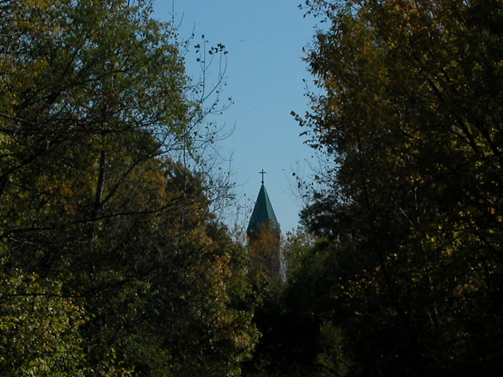
Church #1 is True Grace Baptist Church, a storefront-style worship space at 2319 Cass Avenue.


Church #2 is actually one block west from the Pruitt-Igoe site, but there are no intervening buildings to block the view. This is Zion Temple Missionary Baptist Church at 2700 Thomas Avenue.


Church #3 is the famous St. Stanislaus Kostka Church at 1413 N. 20th Street, which pre-dates the construction of Pruitt-Igoe by over a half-century.


The other northern-leading path's view terminates at the rear of the Mullanphy Tenement, visible across the parking lot of the Absorene Company.

The Pruitt-Igoe grounds hold both the history of the failed but once proud housing projects as well as years of dumped debris. The layers of fill and remains have not stopped healthy vegetation, and much of the site resembles a nature preserve. the access roads, which are largely clear, gives the site's wild state a sense of intention. The presence of the three churches closing the long views down these paths adds serenity to the scene. The churches' presence on the margins of the Pruitt-Igoe site call to mind the notion of redemption. In its current state, the Pruitt Igoe site seems to have cleansed its historical wounds and reconciled with nature. The site's current ecological state is wholly new and supportive of new life. Has this tortured land met its redemption?

UPDATE: Reader Bill Michalski sent me a still frame from the film Koyaanisqatsi, where True Grace Baptist Church is evident in footage taken in 1972.

Friday, June 20, 2008

Land Use and Flooding

From "Iowa flooding could be man's fault, experts say" (Washington Post):

Between 2007 and 2008, farmers took 106,000 acres of Iowa land out of the Conservation Reserve Program, which pays farmers to keep farmland uncultivated, according to Lyle Asell, a special assistant for agriculture and environment with the state's Department of Natural Resources (DNR). That land, if left untouched, probably would have been covered with perennial grasses with deep roots that help absorb water.

Thursday, May 29, 2008

Urban Prairie in Downtown Evansville, Indiana


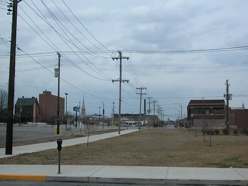
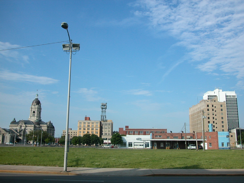
In the heart of Evansville, Indiana, just across the street from the former federal building, is this half-block of vacant earth. It's not a construction site. It's not a parking lot. It's just land with grass growing on it.

Factory Farming in Missouri

The Joplin Globe published an excellent article on confined animal feeding operations (CAFOs) in Missouri: "Study: CAFOs affect neighbors' property". These operations have been replacing traditional animal farms for years -- bringing with them debilitating conditions for animals, food packed with growth hormones with unresearched effects on consumers and now problems for neighboring human and animal populations through waste-water run-off. This is not to mention the number of family farms lost through factory farming.

In the St. Louis region, there are many CAFOs in Illinois counties like Monroe and Missouri counties like Jefferson and Lincoln. Urbanists often talk about stopping sprawl through growth boundaries and form-based zoning, but there is a much less frequently-addressed part of the sprawl question. If we stop the creep of the suburbs, what do we want the rural lands surrounding St. Louis to look like? What sort of land uses are sustainable and acceptable, if large subdivisions, strip malls, office parks and the like are out of the question? What jobs will people have?

Healthy agriculture is key to sustaining open land around the metropolis. Currently much of the land within our Standard Metropolitan Statistical Area is devoted to farming. As the energy crisis mounts, that amount of land may not change much. Yet "farming" as we know it has been altered to an unrecognizable world of factory farms, hormones, chemicals and corporations. Does agriculture in current practice serve the interest of a sustainable St. Louis region, or do we want to adopt a model that conserves our rich soil, sustains open space, preserves what's left of family farms and prevents the poisoning of surrounding land?

Sunday, April 13, 2008

A Lonely Stand


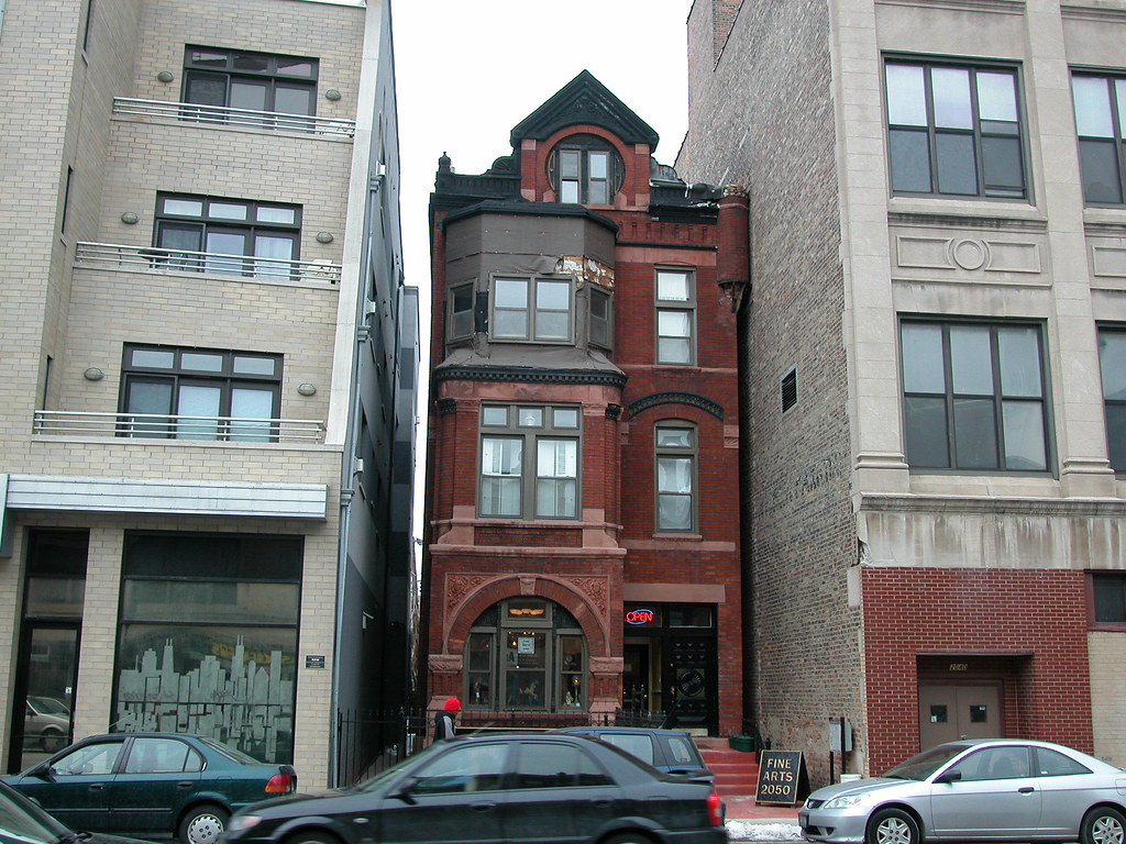
The future is always doubtful to that last historic house on a block in a neighborhood whose primary land use has changed. Neighborhoods just outside of the central business district of American cities that were residential walking neighborhoods typically lost their character in the twentieth century as commercial use crept outward. Large new buildings went up on main thoroughfares, followed by mixed use and apartment buildings on other streets. Old houses became rooming houses, offices and even small factories -- until their narrow lots were added to adjacent lots to make sites for larger buildings. Secondary streets often kept much of the old housing stock, but the main streets emerged from second wave development looking more like downtown than ever.

On some blocks, like the one shown above on North Avenue just west of Milwaukee in Chicago, one will find the houses that survived the development waves. Some of these houses stand alone, adjacent to parking lots. Their futures are doubtful, since they stand apart from the historic context that would make their defense likely should a developer want to take the house and the adjacent lot and build a new building. In Chicago, tear-downs like that seem to happen weekly. The new construction is often an insipid four or five story building with street level retail and condominiums above, rendered in a bland minimalist style or a gaudy postmodernist mess.

Other survivors are more fortunate, like this old Romanesque Revival house. When the building to the right went up in the 1910s, the developer didn't need, want or buy the house. When the building on the left went up, the same story. Neighbors came down, but not the erstwhile little house. The house slipped through both times. With such a small site, and the house being so close to the neighbors, one could guess that the house has escaped demolition. Then again, in urban real estate, nothing is ever certain.

There were years in recent memory when this stretch of North Avenue were devoid of much development interest, and then things changed rapidly. Even if the market is in downturn now, that won't last forever. Some locations hold inherent value that survives the market's cycles. Some buildings do too. Is this house one of those now, by virtue of its escape?

Saturday, April 12, 2008

The Soil Fails

Curtis Eller came up with a song title and phrase so haunting to those of us who live in north St. Louis. "After the Soil Fails" is really a song about a vivid dream inhabited by historical figures like William Tecumseh Sherman, but its references to the imagined deaths of New Orleans and Philadelphia invoke the condition of emptying sections of St. Louis.

"One of these days the soil is going to give out," warns Eller. While the causes of much of the loss of the built environment of north city is more economic, the landscapes left behind are devoid of any clues. To the innocent wanderer, perhaps it seems that the very land on which the city is built is dead. Just as bad soil kills crops, bad land could kill blocks or neighborhoods. The difference is that the infection of farm soil is real, while the infection of our city soil comes from within us, legitimate brown fields notwithstanding. City land is as good for city life as ever. Trouble is, city land's healthful properties come not from its physical content but from how it's labeled on maps and valued by builders. An ounce of soil from a lot in St. Louis Place could be as nutrient rich as any found in Clayton, but that has nothing to do with the value of the land it composes.

Hence, the best soil for farming in the region may be in places like the floodplains of St. Charles County, while the better soil for building could be the bedrock-pinned land of north city. We don't seem to mind this absurdity as continue to build out irresponsibly. If soil affected our settlement patterns as it does planted crops, our soil would have failed awhile ago. Maybe it still will.

Monday, March 10, 2008

Kaskaskia Remains


The villages of Dozaville (once Goshen) and Kaskaskia, Illinois remain as vestiges of settlement on Kaskasia Island. Dozaville is a complete ghost town, at least officially -- it has been legally dissolved for decades. Kaskaskia remains incorporated, although with less than a dozen residents in four households within its boundaries has no real need for civil government. Kaskaskia is one of those places that has achieved zero population growth according to the US Census -- a bizarre stasis for a town once of great importance.

Although part of Randolph County in Illinois, the island is west of the Mississippi and accessible only via a bridge from St., Mary's, Missouri. A shallow channel barely recognizable as a river separates St. Mary's from the island, suggesting that the land nearly is part of Missouri. On maps, the land seems fully engulfed by Missouri. Most maps don't even note the channel with water, but merely include a political boundary line. Kaskaskia seems an improbable location for Illinois's first state capital. Now remote, plagued by low land that constantly floods, and insular, Kaskaskia was once a vital part of early French settlement of the Mississippi River valley. The island was once an attached Illinois peninsula.

In 1673, Louis Joliet and Father Jacques Marquette claimed the Mississippi River valley in this area. In 1675, Marquette visited the site of Kaskaskia and established the mission of the Immaculate Conception. The mission became a church, and the settlement around the mission grew into a village with fur trading and farming as prevalent economic activities. In 1703, Kaskaskia was founded as the second village of European settlers in Illinois. By 1752, the population stood at a relatively robust number of 671 residents.

At the advent of the French and Indian War in 1756, French townspeople built Fort Kaskaskia on a hill east of the town, now across the Mississippi River. Residents destroyed the fort to prevent it from falling into British control when the British won. Many residents fled to Ste. Genevieve after the war. Later, the British built Fort Gage in Kaskaskia but lost the fort to Revolutionary General George Rogers Clark in 1778.

Kaskaskia became Illinois territorial capital in 1804. In 1818, the newly-created State of Illinois chose to retain Kaskaskia for the first state capital, although for only two years. The Emigrant's Guide of 1818 states that there were 150 houses standing in the village. Growth would not arrive, however, as the village quickly lost the capital to more centrally-located Vandalia. One notable event happened after the loss of the capital: the establishment of the convent and school for the female school Visitation Academy in 1833.

However, the biggest blows to the village's fortune came with terrible floods in 1844 and 1881. Located at a narrow spot between the Kaskaskia and Mississippi Rivers, the site was vulnerable to the Mississippi's eastward shift. Eventually, that river pushed over the narrow neck of the peninsula to create the present island. The first flood caused great population loss, and the second flood created the river channel that made the land around Kaskaskia into an island. During the period between the floods, Visitation Academy relocated to the city of St. Louis in 1844. After an 1893 flood, the town relocated to its present location.

In 1993, flood waters again submerged the island and caused residents to flee. Nowadays, the population of Kaskaskia is about 9 and the population of the island is about 93 people. Kaskaskia still retains its street grid, which carves out blocks punctuated by the few remaining buildings.

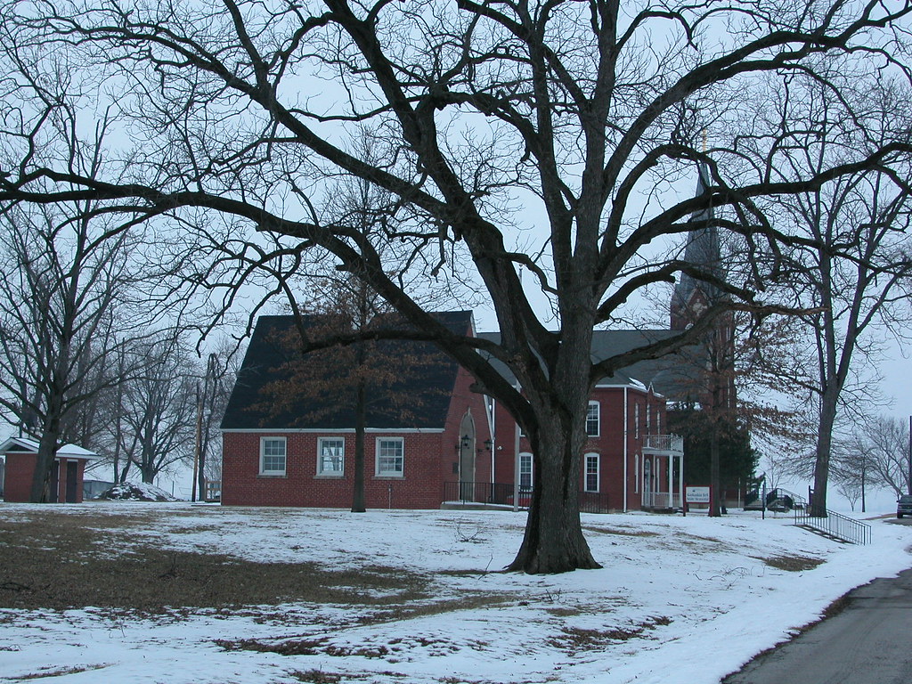
One of those remaining buildings is the Church of the Immaculate Conception, built in 1882 and moved to its current site in 1894 after the devastating 1893 flood. A church founded by Marquette now meets only on Saturday afternoons -- strangely diminished in human size but awesome in the length of its existence. The brick building has managed to survive several floods with its Gothic Revival architecture intact.


A long-time parishioner is profiled in the article found here.

A newer building is the home of the church's historic bell, gifted by the King of France in 1741 and known as the "Liberty Bell of the West" since the townspeople rang it on July 4, 1778 to celebrate liberation from British rule.

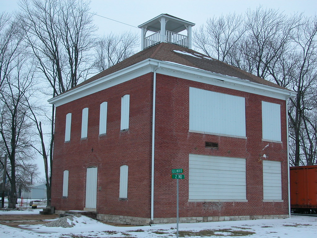
The old school house is interesting, although badly damaged by flooding and alterations to its fenestration. Boarded up, the brick building is missing much of its interior structure although it has gained a new roof since the 1993 flood. Reuse seems unlikely, although someone is performing enough continued maintenance to ensure survival of the old building.


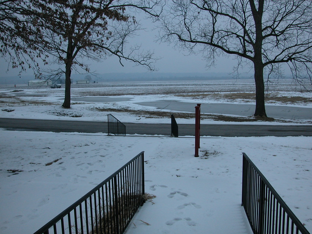
A few frame and brick homes comprise the rest of Kaskaskia. The wide sight lines of the island ensure views of the church spire and school house framed by expanses of fields. Settlement has come full circle for Kaskaskia, but somehow it endures.
Friday, October 26, 2007

Detroit Park Sale Plan is Hasty

The administration of Detroit Mayor Kwame Kilpatrick is proposing selling off 92 of the city's 367 parks. Most of the parks on the sale list are pocket parks and small playgrounds, many of which are surrounded by vacant lots and some of which are in severe disrepair. Kilpatrick seems to think that some of the park sites would be ripe for new development. The plan raises the issue of public space planning in deindustrialized cities. The amount of park space in Detroit reflects peak density that has not existed in decades. Does the city need so much park space when so much of the city itself is green ghetto land?

Maybe not. Detroit is seeing redevelopment right now. Kilpatrick's interest in selling the parks shows confidence in their having some market value as lots. The city has shrunk, but as it grows it may need the parks. While there are many of the 92 parks that probably will never be useful, there are some that are useful now and would be useful in neighborhoods where infill construction will lead to higher density. Staking out public space now will ensure that neighborhoods don't lack amenities that belong to all residents.

Detroit might consider holding off on a massive sale, and releasing the parks one by one after further community input and investigation of development activity. Perhaps some parks should just be mothballed -- infrastructure demolished and grass planted. One thing we learn from cities like Detroit is the inherent power of a vacant urban lot. From the vacant lots will spring the development of the future -- and public space needs to be part of that.

Wednesday, September 26, 2007

3500 North Grand: One of LRA's Many Available Buildings


Photo from Land Reutilization Authority.


This three-story commercial building with a distinctive chamfered corner stands at 3500 N. Grand Boulevard (northeast corner of Grand and Hebert) in the Lindell Park neighborhood. Formerly home to a bank, this building in the Classical Revival style was built in 1909.

This is just one of the thousands of properties owned by the city's holding agency, the Land Reutilization Authority (LRA). LRA seeks $15,000 for this building -- a price below market value. A recent sales contract fell through and the building is again on the featured properties section of LRA's website.

Last September, I published a blog entry entitled "LRA's Problem With Marketing: It Needs to Start." I chastised LRA for leaving properties that had sold in the featured properties list without adding new ones. One year later, I am pleased to report that LRA's website features only available properties on this list. I am not pleased to report that the online list still represents the bulk of LRA's marketing efforts.

While many blame LRA itself, that's a cop out. As a municipal authority, LRA is hidebound to funding and operational binds placed on it by those with budgetary and legislative authority. Ultimately, each of us city residents is a stakeholder in LRA. LRA's staff cannot effect major and necessary policy changes related to the disposition of city-owned buildings and land -- but our elected representatives can.

Thursday, September 20, 2007

The Crisis of Abandonment

A recent article published on Preservation Online entitled "Winging It in Buffalo" provokes thoughts about the nature of widespread urban abandonment. In the article, writer Stephanie Smith discusses the situation of Buffalo, New York, where city leaders have started a "Five by Five" program to bring its vacant building rate closer to five percent within five years by demolishing 1,000 buildings a year. City planners there estimate that 10,000 buildings should be demolished.

This campaign to "right size" the city makes sensible historic preservation planning next to impossible. The Buffalo preservation board has to consider 1,000 applications a year. There is no way that preservation board members can even begin to make sense of what comes across their desks. At the same time, city leaders at least pay lip service to the idea that massive clearance is ultimately detrimental to neighborhoods.

The larger issue here is relevant to St. Louis and other cities: widespread abandonment creates public safety and land use crises of unprecedented scale. Natural time dooms many historic buildings, while political time expedites that process. Economic time brings solutions slowly, and may not move fast enough for the comfort of residents who remain in areas where abandonment is rampant. While the federal government has spent billions of dollars on supposed crises in nations like Iraq, we have failed to direct it to play a meaningful role to resolve our urban crises. Local problems rely on local solutions -- and severely limited local budgets. How and when do we break from this cycle?

(Thanks to my colleague Lindsey Derrington for the link.)

Tuesday, May 2, 2006

The South End of Old North

The southern end of Old North St. Louis -- which includes the National-Register-listed Mullanphy and Sts. Cyril and Methodius historic districts -- has been recently cut off from the more vibrant part of the neighborhood by two unfortunate grid-busting, suburban-style housing projects and cut off from downtown by vacant lots, fast food restaurants and automobile and truck yards. Demolition has been rampant, and truck-related businesses own many buildings here. Speculators have seized some of the area, including an impressive half-block owned by Blairmont Associates LC. There is one city block -- bounded by Tyler on the south, 13th on the west, Chambers on the north and Hadley on the east -- where not a single building stands.

Yet the last few weeks have seen signs of life no one could have predicted: a side-gabled, two-and-a half-story house at 2111 N. 13th Street that is the last building on its block is undergoing renovation; someone purchased an LRA-owned building at 1723 N. 13th Street in March and has already made progress on rehab; the owner of a corner tavern at the southeast corner of Howard and 14th streets has taken down part of a brick wall for relaying. These rehabs are by no means historic, and in the case of 2111 N. 13th, maddening for a preservationist to observe. Yet given the economy of that end of Old North, even these projects are somehow comforting -- rather than crumbling shells, we have two bad rehabs to critique. (We will need to go a long way before even contemplating local district standards on acceptable alterations.)

The strangest event lately had to be the revival that took place over the weekend on the south end of that totally-vacant city block. A church group threw up a tent, put out folding chairs and a port-a-potty, and brought in preachers and bands. The scene was almost surreal, especially amid the stormy weather of the last few days.

Hopefully, someone will make a more long-term investment in that block, which would make a great location for modern infill housing. In fact, I would love to see both the 1970s-era Murphy-Blair Apartments and the Bristol Place Townhouses developments fall to the wrecking ball for a large-scale infill project. With vacant land to the north of both projects along Monroe Street, a new project with restored street grid would meet the North Market Place redevelopment project. With rehab of the remaining historic buildings in this area, reclamation of the Blairmont land for responsible use, and the stabilization of the Mullanphy Emigrant Home, this end of Old North would blossom.

It's comforting that a few good things are happening despite the barriers of the two housing projects. Yet there's no way much else will happen until the barriers are removed.

Friday, April 14, 2006

Rectangular Signs, Triangular Problem

We saw some interesting yards signs last night on the 3700 block of Arkansas (a.k.a. Pyramid's half-built Keystone Place), just a few feet from where the new McDonald's is supposed to be built:

NO
DRIVE-THRU
HERE

SAME
McDONALD'S,
SAME
McLITTER

PYRAMID:
DON'T
COP OUT

ASK
FLORIDA
WHY

Wow. Those are some strong sentiments coming from those homeowners (and I agree with them!). As we went around the corner, we saw one more sign:

SAVE
KEYSTONE
PLACE

How telling about the way that St. Louis is being developed by many of our most prominent big names. Pyramid has yet to even finish this previous development, and already its residents feel that it is in danger. What puts it in danger? Why, another potential Pyramid project, when they haven't even completed the last one on that block!

Thursday, November 17, 2005

Dead Zone

The empty land in downtown St. Louis fronting Locust Street between 8th and 9th streets covers over one-half of a city block. This land is surrounded by numerous historic buildings: the Board of Education Building, the Orpheum (later American) Theater, the Mayfair Hotel, the Mercantile Bank Building and the rear end of the Old Post Office. The site is prominent, but the space is dead.

Currently, this entire space is covered by three parking lots. One of these lots is crudely paved with gravel ringed by the top of a remaining foundation walls of a now-gone building. The sidewalk along Locust is in horrible disrepair. This area is a visual and functional dead zone in a downtown rapidly gaining pedestrian movement.

Civic bigwigs want to keep it that way, except they would replace the asphalt and gravel covering the lot with grass. They have released proposed renderings of a sterile and ill-designed "plaza" that is too large to be a good urban space and too devoid of uses to remedy the blight of the location.

The one use the planners have allowed to intrude upon the site is an ugly glass-walled addition to the Mayfair Hotel, proposed by the Roberts Companies. This addition would sit in from the sidewalk lines, and not even come close to fronting Locust or Eighth streets. Yet it would be large enough to make building a building at the corner feasible. The design is based upon the site's always being dead space.

Could we please bring this site back to life? The last thing downtown needs is more open space. One block to the east of this site is the more modestly-sized "plaza" built by Mercantile Bank on the site of the Ambassador Building, wrecked in 1996 and 1997. This open space consists of a big driveway and some landscaping, so it's pretty unattractive. But its size is not wholly inappropriate to a big city and, if a building were built across Locust on a parking lot, the site would be framed tightly. If Mercantile would turn the site over to civic use (there is not even a place to sit on the site at present), this could be a fairly urban downtown plaza.

Let's be sensible.