

Showing posts with label riverfront. Show all posts
Showing posts with label riverfront. Show all posts
Tuesday, June 8, 2010
Park Service Offering Bike Tours of the North Riverfront Trail
Via the Jefferson National Expansion Memorial, the The National Park Service is offering free ranger-led bike tours of the North Riverfront Trail this summer. The North Riverfront Trail passes through or near many historic sites ranging from still-active industry to the Mary Meachum Freedom Crossing.


Saturday, June 5, 2010
The Untold Story of the Gateway Arch
by Rick Rosen
Over the course of a century a community took shape on the riverfront in St. Louis. At the same time, what happened in that community shaped the history of the nation. Finally, as those years of destiny unfolded, St. Louis came to see itself as a capital, as the great center of the Midwest.
But then, the currents of history changed. The river of history shifted its course and bypassed that community. Chicago, not St. Louis, became the capital of the Midwest.
Ever so gradually, the riverfront was forgotten. Then it decayed. Finally, it became an embarrassment to the still thriving but less influential community that had grown up around it following its century of greatness.
In that larger community, the humiliation of having lost out to Chicago lingered on. The embarrassment ran deep and it was accompanied by amnesia -- a defense mechanism to cope with humiliation. The amnesia masqueraded as conventional wisdom: the riverfront is economically obsolete with regard to its building stock; the riverfront is obsolete in relation to advances in transportation technology; the riverfront is out of date in comparison to current styles of architecture.
All this conventional wisdom was, of course, true. However, it took hold not because it was true, but because it addressed a psychic need to mask the profound sense of loss that ate at the community’s identity, a loss for which the decaying riverfront was a constant reminder.
And then the great depression arrived. Luther Ely Smith, a man of great vision and a respected leader in his deeply embarrassed community, remembered that first century of greatness -- and was appalled by its decadent reflection in the mirror of the nearly abandoned riverfront. He dreamed of something to replace the decadence, something that would bring back to life that lost century of greatness. Smith prevailed on the federal government -- in response to the depression—to build a national park on the riverfront. Then he organized a design competition to create a new vision for the site.
And of course he succeeded -- beyond his wildest dreams -- with the Gateway Arch and its surrounding park grounds. But there was a cost.
A city's built environment is nothing less than the accretion of its history. Whenever elements of that environment are wiped away, the material record of that history is lost. When the riverfront was cleared after 1939, the elements that were lost were the very elements Luther Ely Smith sought so hard to recover.
Any built environment tells the story of its history. But it’s also true that it tells that story in a special language, an arcane language that only people who are drawn to history, and those whose personal memories are embedded in its buildings, can easily understand. Still, despite its weaknesses, it is by far the best language for telling a community’s story. When it's silenced, other languages must be found if the story is to be remembered at all.
Today, a second design competition for the riverfront is in progress. This competition presents a magnificent opportunity for St. Louis and it has already generated widespread excitement. Most of the excitement focuses on possibilities for new connections between the arch grounds and the rest of the city. However, with the original built environment of the riverfront long since gone and forgotten, the hidden challenge of the competition is to find the next best language to tell that lost story. Then, and only then, can the amnesia that has prevailed for so long in St. Louis finally be healed.
Rick Rosen is an architectural historian and downtown resident. Contact him at RARstl2@aol.com.
Over the course of a century a community took shape on the riverfront in St. Louis. At the same time, what happened in that community shaped the history of the nation. Finally, as those years of destiny unfolded, St. Louis came to see itself as a capital, as the great center of the Midwest.
But then, the currents of history changed. The river of history shifted its course and bypassed that community. Chicago, not St. Louis, became the capital of the Midwest.
Ever so gradually, the riverfront was forgotten. Then it decayed. Finally, it became an embarrassment to the still thriving but less influential community that had grown up around it following its century of greatness.
In that larger community, the humiliation of having lost out to Chicago lingered on. The embarrassment ran deep and it was accompanied by amnesia -- a defense mechanism to cope with humiliation. The amnesia masqueraded as conventional wisdom: the riverfront is economically obsolete with regard to its building stock; the riverfront is obsolete in relation to advances in transportation technology; the riverfront is out of date in comparison to current styles of architecture.
All this conventional wisdom was, of course, true. However, it took hold not because it was true, but because it addressed a psychic need to mask the profound sense of loss that ate at the community’s identity, a loss for which the decaying riverfront was a constant reminder.
And then the great depression arrived. Luther Ely Smith, a man of great vision and a respected leader in his deeply embarrassed community, remembered that first century of greatness -- and was appalled by its decadent reflection in the mirror of the nearly abandoned riverfront. He dreamed of something to replace the decadence, something that would bring back to life that lost century of greatness. Smith prevailed on the federal government -- in response to the depression—to build a national park on the riverfront. Then he organized a design competition to create a new vision for the site.
And of course he succeeded -- beyond his wildest dreams -- with the Gateway Arch and its surrounding park grounds. But there was a cost.
A city's built environment is nothing less than the accretion of its history. Whenever elements of that environment are wiped away, the material record of that history is lost. When the riverfront was cleared after 1939, the elements that were lost were the very elements Luther Ely Smith sought so hard to recover.
Any built environment tells the story of its history. But it’s also true that it tells that story in a special language, an arcane language that only people who are drawn to history, and those whose personal memories are embedded in its buildings, can easily understand. Still, despite its weaknesses, it is by far the best language for telling a community’s story. When it's silenced, other languages must be found if the story is to be remembered at all.
Today, a second design competition for the riverfront is in progress. This competition presents a magnificent opportunity for St. Louis and it has already generated widespread excitement. Most of the excitement focuses on possibilities for new connections between the arch grounds and the rest of the city. However, with the original built environment of the riverfront long since gone and forgotten, the hidden challenge of the competition is to find the next best language to tell that lost story. Then, and only then, can the amnesia that has prevailed for so long in St. Louis finally be healed.
Rick Rosen is an architectural historian and downtown resident. Contact him at RARstl2@aol.com.
Tuesday, March 16, 2010
Play on Sunday Tells the Story of the St. Louis Riverfront
 Plate showing central riverfront from Pictorial St. Louis, 1875.
What: "Voices of the Riverfront"
When: Sunday, March 21, 2:00 p.m.
Where: Old Courthouse
Cost: Free
Voices of the Riverfront will bring to life some of the characters who shaped and chronicled the development of St. Louis' riverfront -- from Auguste Chouteau to Ernst Kargau to Hubert Humphrey. Written by sisters Nini and Sheila Harris, the play will be performed as a radio-style reading. The cast includes Jennifer Clark, Charlie Clark, Bill Hart, Doug Dunphy, Bob Officer, Jennifer Halla Sindelar, Craig Schmid, Jenny Heim and Michael Allen. Jim Mayhew will provide instrumental accompaniment.
The play lasts about one hour. Refreshments to follow.
Tuesday, March 2, 2010
State Court Ruling on the Admiral Hull
The state appeals court ruled today that the Missouri Gaming Commission acted "without sufficient process" when it ruled that Pinnacle Entertainments could "neither repair nor replace" the President Casino, better known as the S.S. Admiral. After considering plans as drastic as scrapping the modernist boat, Pinnacle has explored repairing the aging hull and possibly moving the Admiral to another location.

Model of the S.S. Admiral, collection of Antique Warehouse.
The Gaming Commission currently is trying to shut down the gambling boat by July -- an effort not affected by today's ruling. Still, the ruling helps Pinnacle make the case for repair. Hopefully today's action helps keep a unique landmark afloat. Despite years of interior alteration, the exterior of the Admiral (built to current form in 1940) is as streamlined and sleek as ever. A little rehabilitation would make it shine! A new casino box built in a wetlands, after all, could not hold a candle to the swanky downtown Art Moderne riverboat.
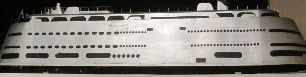
The Gaming Commission currently is trying to shut down the gambling boat by July -- an effort not affected by today's ruling. Still, the ruling helps Pinnacle make the case for repair. Hopefully today's action helps keep a unique landmark afloat. Despite years of interior alteration, the exterior of the Admiral (built to current form in 1940) is as streamlined and sleek as ever. A little rehabilitation would make it shine! A new casino box built in a wetlands, after all, could not hold a candle to the swanky downtown Art Moderne riverboat.
Monday, February 22, 2010
National Park Service Sponsors Look at Lost Riverfront Architecture

The nation's only urban national park, the Jefferson National Expansion Memorial with the stunning Gateway Arch by Eero Saarinen, has long been haunted by a shadow architectural history. To make way for one of the world's most full-realized modernist landscapes, St. Louis wrecked forty blocks of historic riverfront buildings. The significance of these buildings in American architectural history was such that in 1939, eminent architectural critic and historian Siegfried Gideon came to St. Louis to deliver a lecture on the doomed buildings. Gideon not only spoke about the unparalleled mass of cast-iron facades and storefronts found on the riverfront, he implored the city to change course and preserve the riverfront's commercial buildings.
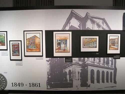 Gideon's cry went unheeded, and plans to create a national memorial to westward expansion on the St. Louis riverfront progressed. Fortunately, the memorial's architectural achievement matched what was lost. Still, the memorial site has a psychological scar tissue to any who know what was lost there. The National Park Service has had some difficulty in interpreting the pre-memorial riverfront so that both the memorial and the prior riverfront architecture are suitably honored.
Thus, the current "Faces of the Riverfront" exhibit at the Old Courthouse is a welcome endeavor, and, given current events, quite timely and inspirational. (The exhibit runs through August 22, through the unveiling of designs by finalists in the current design competition.) The National Park Service gave artist Sheila Harris access to its extensive photographic record of riverfront buildings lost to build the memorial, and she painted in watercolor renderings of the documented buildings. Harris' paintings transform the hard, stoic documentation taken before the riverfront death knell into soft, humane snapshots of a still-living urban landscape.
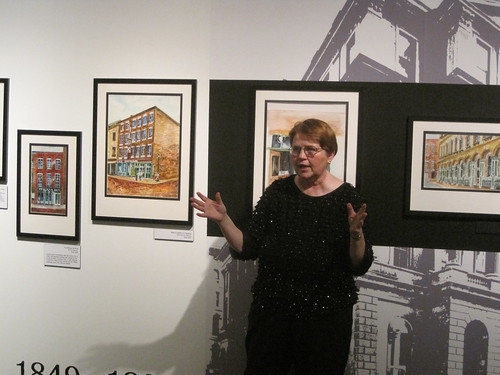 Sheila Harris speaks at the exhibit's opening reception on February 14th.
For the next few months, visitors to the Old Courthouse will be greeted by an exhibit that properly honors the life of the riverfront, in the space once occupied by the courtroom where the Dred Scott trial unfolded. Superintendent Tom Bradley, staff historian Bob Moore and exhibits manager Caitlin McQuade deserve credit for working with Harris to create the exhibit, as does Sheila Harris's sister NiNi Harris (author of the new book Historic Photos of the Gateway Arch.)
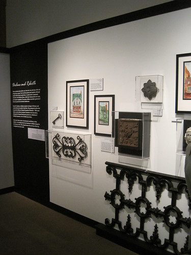 Alongside the paintings are rarely-seen items from the Memorial's collection of salvaged portions of riverfront buildings. Those who have seen the items on permanent display in the Old Courthouse often wonder what else remains, and here are a few answers. The expected cast iron pieces are joined by a more obscure terra cotta piece. The only problem with Faces of the Riverfront is that the fragments and watercolors pique a visitor's interest in seeing the source photographs, of which none are on display save as wall-sized backdrops. Perhaps those photographs will be made public as part of a future Memorial project.
Wednesday, February 17, 2010
A Grand Plan for Memorial Drive
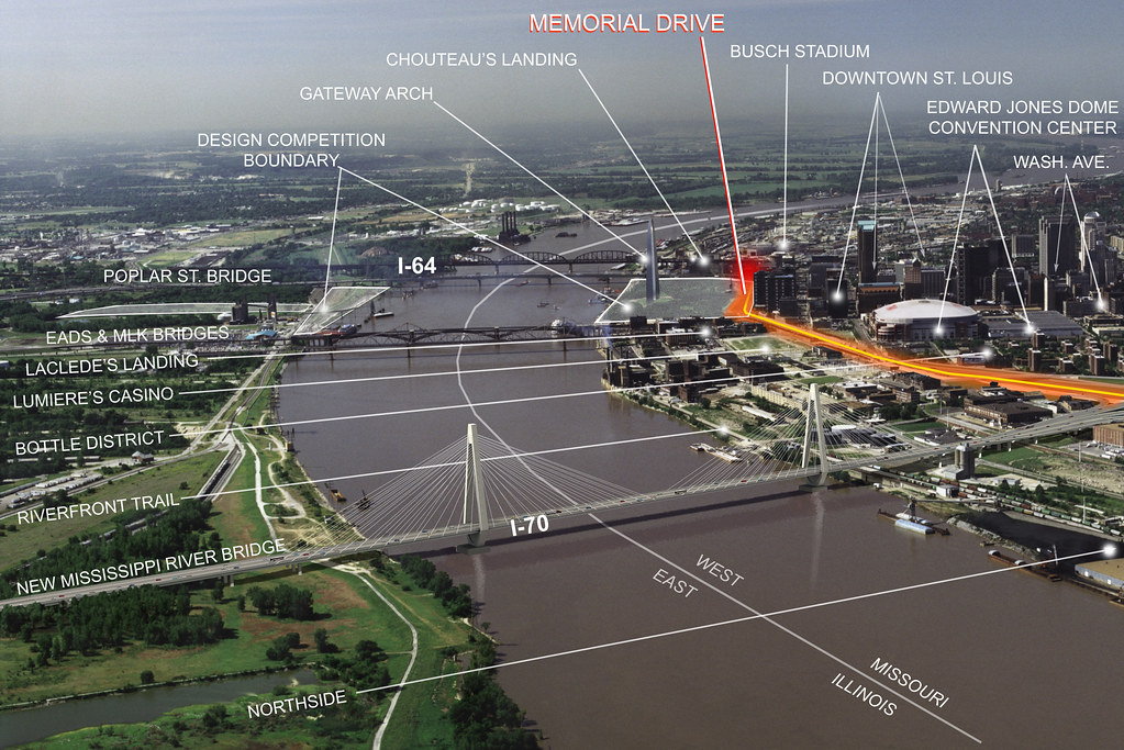
Today, the citizen organization City to River launched its website that presents a thoughtful, creative approach toward building a new Memorial Drive. The analysis and imagery of the website come at a wonderful moment, right after the Framing a Modern Masterpiece design competition jury has chosen the nine design teams that will create full entries. May the design teams spend time contemplating the City to River proposal, and may the design competition's sponsors keep the door open for any team that may wish to embrace a radical way to renew the riverfront connection.
Tuesday, February 9, 2010
"Faces of the Riverfront" Exhibit Opens This Sunday

The Jefferson National Expansion Memorial will host a special exhibit from St. Louis artist Sheila Harris at the Old Courthouse from Feb. 14 through Aug. 22, 2010. Created especially for the memorial, the exhibit consists of nearly 40 watercolor paintings of buildings that once stood on the Arch grounds. Harris' "portraits" of buildings depict structures from several generations of the city's architectural history illustrating how the landscape of the riverfront evolved over time.
The exhibit will launch with an artist’s reception on Sunday, February 14, at 2:00 p.m.
Friday, October 2, 2009
U.S.S. Inaugural Still a Fixture on the Riverfront
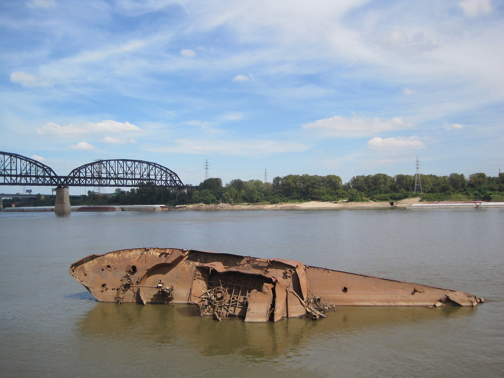 The U.S.S. Inaugural remains a fixture on the St. Louis riverfront, just south of the MacArthur Bridge. Since breaking loose from its moorings and capsizing in a bizarre incident during the great flood of 1993, the old minesweeper has been stuck on the riverfront. After spending a generation as a tourist attraction, the war vessel has become part of the lore of local urban explorers -- and the subject of many schemes to profit from the tragedy.
The ship's remains are almost too easy to find, located just a short walk through a gate in the flood wall. On a sunny Indian summer day, the wreck conveys a sense of tranquility. Later, in the winter, when the water gets lower the ship will beckon explorers. John Patzius has held the salvage rights to the boat since 1998, and had attempted to move the Inaugural out of the river. The mighty gun from the bow of the Inagural is located at Bob Cassilly's Cementland; that relocation by Patzius is theft by his own admission (although rightful theft, by his judgment). Future plans remain unknown. For now, the wreck is a splendid landmark to behold on a weekend ramble. Some days one will find artists hard at work creating murals on the flood wall, almost always atop the work of others. Inexplicably, no one has ever tagged the wreck just a few yards away. (Red Foxx, are you reading?)
More information is available in the U.S.S. Inaugural Online Scrapbook.
Sunday, August 30, 2009
Making a Difference on the Riverfront
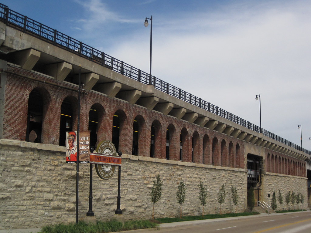
The southern flank of the mighty Eads Bridge has received a major landscape upgrade, due to the efforts of Metro, the Jefferson National Expansion Memorial and the Laclede's Landing Redevelopment Corporation. That is to say, the strip between the bridge approach and Washington Avenue actually now is landscaped! The difference between the formerly part-mulch, part-dirt terrain and the new verdant tree-planted, grassy, flowery setting could not be more stark.
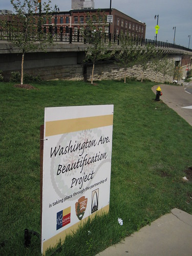 For years, this area was a disgraceful disarray in an area marred by many such urban design problems, including the intrusive elevated section of I-70, the parking garage barrier on the northern edge of the Memorial and the lackluster riverfront itself. The "Washington Avenue Beautification Project" does not resolve these larger issues, but vanquishes the terrible appearance of a very-visible area. Pedestrians on the Eads Bridge can now look out at the Gateway Arch and grounds, and look down and see an extension of that inviting park setting.
I do have a quibble with the project concerning the lack of sidewalk on most of this side of Washington. (The other side of the street has a continuous sidewalk.) The photograph on the left shows the sidewalk running east from Second Street to First Street, while that on the right shows the strip running west.
 |  |
Addition of metered parking here -- something that Metro, operator of the garage, would likely oppose -- would be desirable. Meters would relieve parking problems on the Landing and calm traffic. However, a continuous sidewalk would be needed. Perhaps this issue can be explored in any design competition that the National Park Service (NPS) undertakes for the Memorial. NPS' draft general management plan for the Memorial identifies the parking garage site as potentially worth repurposing, so this corridor could be transformed at some point.
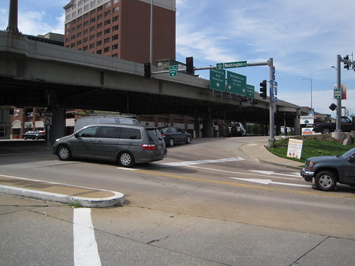 Of course, the sidewalk would lead westward walkers out into the morass of the Eads Bridge/Memorial Drive/Washington Avenue intersection. This intersection may be the most confusing in the city! Hopefully any design competition will lead to resolution of this problem, which plagues one of the Memorial's key entry points. Removal of the interstate is the most direct way to clarify traffic issues here, but that removal is probably on a slower track than the design competition timeline. Who knows? Perhaps the design competition will be the impetus for grad civic thinking on urban design, and our political leaders will embrace a visionary change downtown like those who laid out the Memorial did so long ago.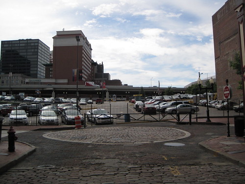
For now, the most-traveled pedestrian path between downtown and the Landing is right here. Can't see the path? Well, look carefully. There is a gate-sized opening in the fence of this parking lot on Second Street. People walk back and forth across this lot all day long, because it remains the most direct link between the Landing and downtown. It does not require much imagination to recognize that there is a major connectivity issue here. A sidewalk on Washington would have helped, although the larger disconnect between the riverfront and downtown remains the big problem.
The Washington Avenue Beautification Project points the way to a realistic way to implement changes to the riverfront that will add up to transformative action. While we need visionary leadership on the riverfront design challenge, we also need resolution of glaring quality of experience problems whose resolution is obvious. This space on Washington needed landscaping, and now it is landscaped. Laclede's Landing needs a better pedestrian connection to downtown. Perhaps a sidewalk on the north side of Washington is the way to go -- narrow the street, build a sidewalk along the new plantings. Perhaps the path already being used could be formalized through reconstruction of Lucas Avenue west through the parking lot. Let's follow one change with another and keep the momentum rolling.
Saturday, July 18, 2009
Old Armour Company Warehouse Lost
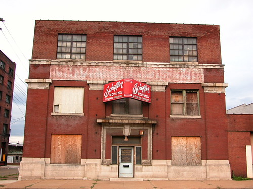 The Schaeffer Moving Company had long occupied the three-story building at 2422 North Broadway, and its red enameled sign (once ablaze through neon tubing) was a familiar site to those who work and live around the area. The steel-framed building actually began its life around the turn of the century as a two-story distribution warehouse for meat-packing giant the Armour Company. The third floor was added in 1911.
 The side elevation facing Benton Street (now legally vacated) was an impressive run of steel-sash windows. After the moving company vacated the building about a decade ago, the possibility for reuse easily was apparent.
Instead of reuse, however, the holding company that owns the large row of warehouses to the north (2508 N. Broadway LLC) opted to demolish the old building this month. With the street now vacated, that company can assemble a large parking lot for those buildings.
Since the old Armour building lies in the Fifth Ward, there is no preservation review that might have prevented this senseless loss. The Fifth Ward is one of eight wards out of 28 that does not participate in the city's preservation review program. (More here.)
 Hence, this is what the building looked like yesterday afternoon. Gone. Soon, the ruinous Armour Packing Plant in East St. Louis will also fall, and we will have few tangible traces to our city's crucial role in the development of the company that turned meatpacking into a science. Yet we will have a few more places to park our cars -- not bad, eh?
Wednesday, June 3, 2009
Goldenrod Showboat Celebrates its Centennial
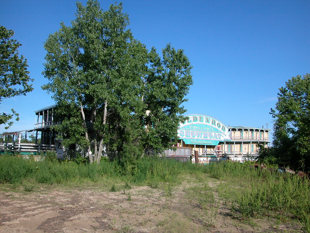 The day was beautiful, and our need for a trip away from the city strong. Looking for a destination, we settled on tracking down the Goldenrod Showboat on the Illinois River. After all, we are in the venerable entertainment vessel's 100th year. Using directions from a friend sent last year after he stumbled upon it and Google Earth (which showed it a few miles from where it actually lies), we got a general idea of the location in Kampsville, Illinois and set out.
Of course, the Goldenrod now sits outside of its first Kampsville location. After not finding the boat on the town's riverfront, we asked a couple walking down the road how to find it. The man knew where it was, gave directions and proceeded to offer the information that his aunt was a waitress and actress on the Goldenrod between 1945 and 1950. Even in this unlikely new home, the Goldenrod is part of a local's family heritage -- how 'bout that?
A few miles later, we spotted the Goldenrod moored to a barge on a section of overgrown riverfront. The boat was unmistakable, and the deterioration has not claimed much of its integrity. Everything is still there, down to the boat's recent (and somewhat unattractive) paint scheme. The paint is peeling, the wood drying and in some places rotting. Yet the Goldenrod survives unharmed in its sleepy Illinois berth.
A few years ago, this outcome was far from likely. After its itinerant early years (more on those later), the show boat became a permanently-moored restaurant on the St. Louis riverfront. In 1990, the City of St. Charles, which had purchased the boat in 1988, moved it to the St. Charles riverfront. The restaurant closed in 2001, and in 2003 the city decided to sell the boat. The St. Charles City Council accpeted bids, and sold it to a company headed by John Schwarz. (The Council rejected Bob Cassilly's bid to move it back to the St. Louis riverfront.) Schwarz moved the boat to Kampsville, after announcing plans to restore the vintage vessel.
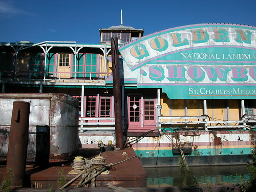
However, in 2007, Randy Newingham and Shelia Prokuski, owners of the site where the boat was moored, sued Schwarz for unpaid mooring fees. In September 2007, Newingham threatened to sell all or part of the boat for scrap to cover his costs. One month later, a Calhoun County judge ordered an auction of the boat, and the court accepted Newingham and Prokuski's lone $50,000 bid. However, by the end of the year the couple had reached and agreement to sell the Goldenrod back to John Schwarz. Schwarz moved the boat north. In 2008, however, Judge Richard Greenleaf declared that the proper court papers for the auction had not been filed, throwing the ownership in doubt. To date, the ownership has not been cleared.
Hence, the Goldenrod Showboat sits lonely on the side of Illinois Highway 100, and as summer sets in, disappears behind stands of grasses and the leaves of riverbank trees. The sturdy boat is crumbling, but not very rapidly. Asphalt roof paper provides cover for much of the deck area, and the boat is locked up tight. Hopefully, this is not how the Goldenrod will end its days, even if this sad state is how the boat will spend its centennial year.

The path from birth has been convoluted, but most of the Goldenrod's days have been good ones. Pope Dock Company of Parkersburg, West Virginia built the boat in 1909 for businessman W.R. Markle. Originally, the boat was named Markle's New Showboat. Built for entertainment, the boat would travel the Mississippi and Ohio rivers and stop at town where it would dock. Patrons would come aboard for a night of music, comedy and other live entertainment. According to most accounts, the boat was the last showboat built for the Mississippi and Ohio river circuits. At 200 feet long and 43 feet wide, the boat was one of the largest showboats ever built. The seating capacity was 1,400.
Markle lost the boat through foreclosure in 1913, and the next owner renamed the vessel the Goldenrod Showboat. In 1922, Captain Bill Menke purchased the boat and implemented a 12-month touring schedule. His tenure would be long and fruitful. Menke moored the boat at Aspinwall, Pennsylvania for two consecutive summers, 1930 and 1931. In summer 1937, Menke brought his show palace to St. Louis for repairs but ended up permanently mooring it here. According to "That Landmark on the River," an article by Mary Duffe that appeared in the St. Louis Post-Dispatch on December 10, 1968, the boat hosted stars like Red Skelton, Monte Blue, Kathy Nolan, Major Bowes and others during Menke's tenure. Menke reported that he had to ask patrons in southern towns to leave their firearms at the riverbank.
In 1963, Pierson and Franz purchased the Goldenrod Showboat. A few small fires led to major renovation, including a new steel hull. On Christmas Eve 1967, the National Park Service listed the Goldenrod Showboat as a National Historic Landmark, the highest federal distinction for a historic property. The National Historic Landmark nomination includes a short history of the boat, as well as the fact that the original hull is intact inside of the steel barge that now serves as the hull.
The National Historic Landmark nomination may be skimpy by today's standards of historic documentation, but the nomination's assertion of the great cultural significance of the Goldenrod remains true. This was one of the last and most lavish of the great river show boats, and it may be the only survivor of that type. Its future is important not only to St. Louis, its later home, but to the history of the 15 states the Goldenrod is known to have regularly visited between 1909 and 1937. The centennial of the boat should be a spur toward preservation. If the current owners (whoever they may be legally) cannot figure out how to bring the boat back to life, let's find the person who can.
Monday, December 29, 2008
Kraushaar Brass Manufacturing Company
 I frequently pass by this industrial building at 2509 N. Broadway in the north riverfront industrial corridor, and have long wondered about the distinctive stepped south elevation. On that side, the parapet steps up a full floor above the apparent building height to support a chimney. My first assumption was that the chimney was the remnant of a demolished interconnected taller building. That assumption didn't seem right, though. Time for research.
The 1909 Sanborn fire insurance map (Volume 3, page 52) shows this building alone, with no building standing to the south. The stepped section chimney is part of the building, which Sanborn shows as being a three-story section of the Kraushaar Brass Manufacturing Company. Building permits indicate that the building at 2509 N. Broadway was built in 1904 at a three story height. Since the building was part of an active brass foundry, a destruction of the top story by fire is possible. Several metal-industry related buildings in the north riverfront areas lost top floors to fire. Early processes often resulted in industrial accidents, and we know that heat rises. However, my guess is as likely as simple decapitation of a floor deemed useless for some reason.
My research on Kraushaar Brass Manufacturing is incomplete. Records show that the company was founded by Charles Frederick Kraushaar, a Prussian immigrant born in 1847 who arrived in St. Louis after 1870. Kraushaar started a brass foundry on this block (city block 330, bounded by Broadway, Warren, 9th and Benton streets) in 1873 that expanded in size rapidly. In 1911, when Kraushaar retired, he resided at 3627 California Avenue in south city. His company made a lot of light fixtures, and its products appear in Missouri state government procurement records.
One mystery solved, dozens more created...
Monday, December 22, 2008
Drawing the Connections
Robert W. Duffy's article "To connect the Arch to the city (and the river), find the middle" in the Beacon broadcasts the good news from this weekend: a group of concerned citizens forged a coalition to address the issue of reconnecting downtown St. Louis to the Arch grounds and the riverfront, and vice versa.
The meeting and consensus for forward movement potentially could tie together many disparate strands of thinking:
Former Senator Jack Danforth's call for improving access to the Arch grounds and making the setting more attractive.
The notion of removing I-70 downtown advanced by Rick Bonasch, myself and others, which is enabled by construction of a new Mississippi River Bridge north of downtown.
The National Park Service's release of a draft General Management plan for the Jefferson National Expansion Memorial.
The call from open space advocates and preservationists to refocus public discussion from the museum prospect on connecting the Arch grounds to surrounding urban fabric.
The outpouring of many good ideas in the recent student charrette on the Arch grounds and riverfront.
Mayor Slay's recent attempt to focus planning energy on the St. Louis riverfront.
Chivvis Development's efforts to revitalize Chouteau's Landing.
Plans by Great Rivers Greenway District to develop a South Rivefront Trail that would connect to the North Riverfront Trail in front of the Arch.
Plans for new development at the Bottle District and a second phase of Lumiere Place north of downtown.
Ongoing efforts to redevelop the North Riverfront Industrial Historic District north of Lumiere Place.
Efforts to improve the East St. Louis riverfront, including construction of an architectural museum.
Finally, there is the very real prospect that the Obama administration will look for an initial wave of federally-funded public works projects and will push for long-term funding for urban infrastructure projects.
All of these ideas and plans are in various stages of reality. Most have yet to move beyond talking points and renderings. Isn't the moment ripe to link these plans together through a master vision for the central St. Louis riverfront? The people who came together on Saturday think so, and will spend the next few months trying to link the many ideas for making the city's front entrance a beautiful one.
The meeting and consensus for forward movement potentially could tie together many disparate strands of thinking:
Finally, there is the very real prospect that the Obama administration will look for an initial wave of federally-funded public works projects and will push for long-term funding for urban infrastructure projects.
All of these ideas and plans are in various stages of reality. Most have yet to move beyond talking points and renderings. Isn't the moment ripe to link these plans together through a master vision for the central St. Louis riverfront? The people who came together on Saturday think so, and will spend the next few months trying to link the many ideas for making the city's front entrance a beautiful one.
Thursday, November 20, 2008
Pinnacle Chief: S.S. Admiral Has "A Few Years Left"
Yesterday's article in the St. Louis Post-Dispatch on the fate of the S.S. Admiral ("Boat my move north" by Gail Appleson) reported on both the short-term and long-term fates of the Art Moderne vessel. Pinnacle Entertainment, owner of the boat, plans to move the Admiral to a site just north of the Chain of Rocks Bridge. This move could take place in 2009, if the Missouri Gaming Commission approves.
The more troubling news comes in a quote from Pinnacle Chief Executive Office Dan Lee. According to Lee, the Admiral is close to needing its 100-year-old-hull (the Art Moderne section was built atop an existing 1907 hull) rebuilt, and Pinnacle has no interest in making that repair. Lee told the Post that re-hulling "wouldn't be economical" but he thinks that "there are a few more years left on that hull." How long the S.S. Admiral can survive remains uncertain.
The more troubling news comes in a quote from Pinnacle Chief Executive Office Dan Lee. According to Lee, the Admiral is close to needing its 100-year-old-hull (the Art Moderne section was built atop an existing 1907 hull) rebuilt, and Pinnacle has no interest in making that repair. Lee told the Post that re-hulling "wouldn't be economical" but he thinks that "there are a few more years left on that hull." How long the S.S. Admiral can survive remains uncertain.
Wednesday, November 19, 2008
Long Lost: First Home of Bremen Bank
The following scanned clipping comes from the January 9, 1949 edition of the St. Louis Post-Dispatch:
 Some readers know of the 1927 Bremen Bank building diagonally across the intersection of Broadway and Mallinckrodt streets; that lovely historic building remains the home of the Bremen Bank.
This clipping is interesting because its caption tells the story of what has happened to large buildings built for specific large tenants when the original tenant moves out. First another large user might come along, with a less prominent use of the space (her, a real estate office). Then comes a second wave of office use, and further depreciation of value. Finally, the property is eyed for a larger development. The story here ends a few months after this blurb appeared in the newspaper. After Mallinckrodt purchased the lovely old bank building, it wrecked it. While the blurb mentions federally-subsidized atomic energy activity, Mallinckrodt actually wrecked the Bremen Bank for a worker parking lot. To this day, the site remains vacant save a small building built on the east end if the parcel in 1994.
In 1949, such industrial expansion along Broadway north and south of downtown was not uncommon. Such expansion came on the heels of the 1947 city Comprehensive Plan, which streamlined land uses to industrial in formerly mixed-use areas along the riverfront while calling for a zoning plan that would allow such anti-urban uses as surface parking on a major thoroughfare. Alas, that zoning plan remains in place, while the land use plan finally changed in 2005. Also remaining is the notion that industrial sites need to spread outward, surrounded by parking and open land, and not be more integrated into city neighborhoods. A clipping like this demonstrates that there are formidable constants in historic preservation and urban design. Nearly sixty years later, a lot remains the same.
North Broadway around Bremen Bank, however, does not remain the same. Mallinckrodt's expansion -- much of it for parking -- erased most of the pedestrian quality of that street scape. Besides the bank, only a few other small businesses are open there. Interstate 70 forms a barrier between this area and the populated section of the Hyde Park Park neighborhood to the west. The city government officially draws the Old North and Hyde Park boundaries at I-70, further enforcing the separation. Had things progressed differently, the old Bremen Bank could have been retained along with other buildings on Broadway, with Hyde Park connected to its major employer and to the riverfront.
What is puzzling is that at the same time the 1947 Comprehensive Plan's call for creating an industrial wall along the river was being drafted, civic leaders were also plotting the construction of the Jefferson National Expansion Memorial downtown in order to improve the central riverfront. Did no one see the conflict between the policies? There was already an organic urban connection to the river, and it could have been enhanced as the city began its loss of industry. Industrial expansion policies -- and, I should point out, the Memorial itself -- decimated the street grids, neighborhoods and buildings that bound the city to the Mississippi. The long-term consequences of the old policies are haunting us today. And we don't have as many resources like the Bremen Bank building around to help reconnect us to the riverfront as we started with.
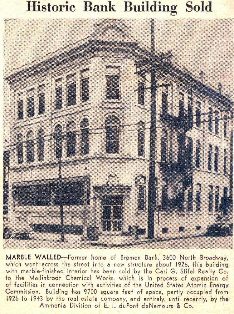 Some readers know of the 1927 Bremen Bank building diagonally across the intersection of Broadway and Mallinckrodt streets; that lovely historic building remains the home of the Bremen Bank.
This clipping is interesting because its caption tells the story of what has happened to large buildings built for specific large tenants when the original tenant moves out. First another large user might come along, with a less prominent use of the space (her, a real estate office). Then comes a second wave of office use, and further depreciation of value. Finally, the property is eyed for a larger development. The story here ends a few months after this blurb appeared in the newspaper. After Mallinckrodt purchased the lovely old bank building, it wrecked it. While the blurb mentions federally-subsidized atomic energy activity, Mallinckrodt actually wrecked the Bremen Bank for a worker parking lot. To this day, the site remains vacant save a small building built on the east end if the parcel in 1994.
In 1949, such industrial expansion along Broadway north and south of downtown was not uncommon. Such expansion came on the heels of the 1947 city Comprehensive Plan, which streamlined land uses to industrial in formerly mixed-use areas along the riverfront while calling for a zoning plan that would allow such anti-urban uses as surface parking on a major thoroughfare. Alas, that zoning plan remains in place, while the land use plan finally changed in 2005. Also remaining is the notion that industrial sites need to spread outward, surrounded by parking and open land, and not be more integrated into city neighborhoods. A clipping like this demonstrates that there are formidable constants in historic preservation and urban design. Nearly sixty years later, a lot remains the same.
North Broadway around Bremen Bank, however, does not remain the same. Mallinckrodt's expansion -- much of it for parking -- erased most of the pedestrian quality of that street scape. Besides the bank, only a few other small businesses are open there. Interstate 70 forms a barrier between this area and the populated section of the Hyde Park Park neighborhood to the west. The city government officially draws the Old North and Hyde Park boundaries at I-70, further enforcing the separation. Had things progressed differently, the old Bremen Bank could have been retained along with other buildings on Broadway, with Hyde Park connected to its major employer and to the riverfront.
What is puzzling is that at the same time the 1947 Comprehensive Plan's call for creating an industrial wall along the river was being drafted, civic leaders were also plotting the construction of the Jefferson National Expansion Memorial downtown in order to improve the central riverfront. Did no one see the conflict between the policies? There was already an organic urban connection to the river, and it could have been enhanced as the city began its loss of industry. Industrial expansion policies -- and, I should point out, the Memorial itself -- decimated the street grids, neighborhoods and buildings that bound the city to the Mississippi. The long-term consequences of the old policies are haunting us today. And we don't have as many resources like the Bremen Bank building around to help reconnect us to the riverfront as we started with.
Clay: Arch Grounds Bill "Technical Placeholder" for Next Congress
Today's Riverfront Times carries an article by Kristin Hinman, "Shaky Grounds: Congress may consider putting the Arch's riverfront park in private hands", in which Congressman William Clay states on the record the intention behind HR 7252, the bill that he introduced in October to cede control of the Jefferson National Expansion Memorial to a private group.
Clay's statement is encouraging:
In a written statement to Riverfront Times, he describes the bill as a "technical placeholder" for the 111th Congress, which begins in January.
"The potential loss of a portion of a national park, even for a worthy public purpose, is a very serious matter," Clay writes. "And it will require extensive public input and community engagement before anything happens."
The congressman is correct. I am glad that Clay put his intentions on the record and supports a public process for considering changes. Hopefully, when the next Congress convenes, Clay refrains from introducing any bill until the National Park Service draft management plan is reviewed by the public and formally adopted in the spring.
Clay's statement is encouraging:
In a written statement to Riverfront Times, he describes the bill as a "technical placeholder" for the 111th Congress, which begins in January.
"The potential loss of a portion of a national park, even for a worthy public purpose, is a very serious matter," Clay writes. "And it will require extensive public input and community engagement before anything happens."
The congressman is correct. I am glad that Clay put his intentions on the record and supports a public process for considering changes. Hopefully, when the next Congress convenes, Clay refrains from introducing any bill until the National Park Service draft management plan is reviewed by the public and formally adopted in the spring.
Monday, November 17, 2008
More Time Needed for Jefferson National Expansion Memorial Planning
I was out of town Friday when KWMU aired my most recent guest commentary:
More Time Needed for Jefferson National Expansion Memorial Planning
More Time Needed for Jefferson National Expansion Memorial Planning
Friday, November 7, 2008
Pinnacle Third Quarter Report Mentions Admiral Relocation
Pinnacle's third quarter earnings report, released yeterday, contains this sentence:
The Company is evaluating the feasibility, subject to gaming commission and other regulatory approvals, of relocating The Admiral Riverboat Casino to another location within the city of St. Louis.
The Company is evaluating the feasibility, subject to gaming commission and other regulatory approvals, of relocating The Admiral Riverboat Casino to another location within the city of St. Louis.
Monday, November 3, 2008
A is Not for the Admiral
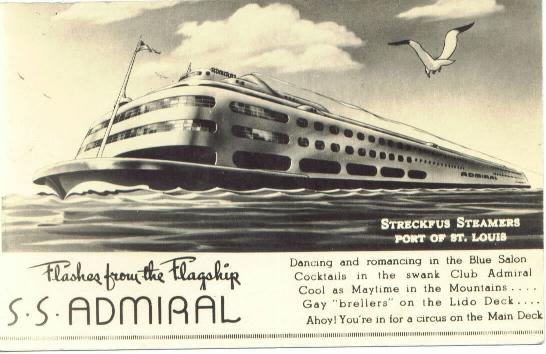 While Missouri Proposition A is not directly about historic preservation, there is a preservation-related consequence: the shuttering of the S.S. Admiral on the St. Louis riverfront. First built in 1907 and rebuilt to jazz-age standards in 1940, the beleaguered Art Moderne boat has lost its engine and much of its original interior, but it retains sophisticated, cool lines on the exterior. Of course, the body of the S.S. Admiral is hidden behind an ugly floating structure on the riverfront side, placing the only clear view from the river channel.
Currently, Pinnacle Entertainment owns both the Admiral and Lumiere Place uphill. Pinnacle's ownership prevents local competition as well as provides a close place where patrons can continue gambling after reaching loss limits at Lumiere. It's a bad system, and I am not arguing that Pinnacle should continue it.
Personally, I support allowing people to decide what to do with their own money. That support extends both to gamblers looking to lay some money down at a casino as well as casino operators looking to open new casinos. Proposition A doesn't allow for a free market in casinos. Rather, it acts as a form of protectionism for current operators. The proposition would lift Missouri's loss limits -- the last left in the nation, but would also limit Missouri's casino licenses to 13. Currently, there are 12 licenses and Pinnacle Entertainment is seeking to secure one for a new casino in Lemay. Obviously, Proposition A is a windfall for Pinnacle and other operators, and a roadblock to competition. I hope that the measure fails and a smarter, competition-oriented policy is adopted. After all, if gamblers will be pouring more money into casinos, they deserve choices.
Back to the Admiral: If Proposition A passes, Pinnacle won't need the old boat. Dan Lee, head of Pinnacle, told the St. Louis Post-Dispatch in September that he might move the boat to a new city location temporarily, but eventually ditch it for a new facility that would assume the Admiral's license. Should that course of events happen, no other operator will be able to buy the Admiral and obtain a gaming license. Any use for the Admiral that does not include gambling probably will fail. Stripped of so many other things, the Admiral has survived. Stripped of a gaming license, the boat won't have much of a future. The threat to the Admiral is not a good reason to vote against Proposition A, but it will be a consequence of its passage.
Wednesday, October 15, 2008
The McPheeters Warehouses: A Total Loss for the City
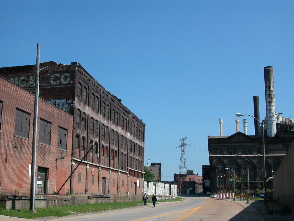
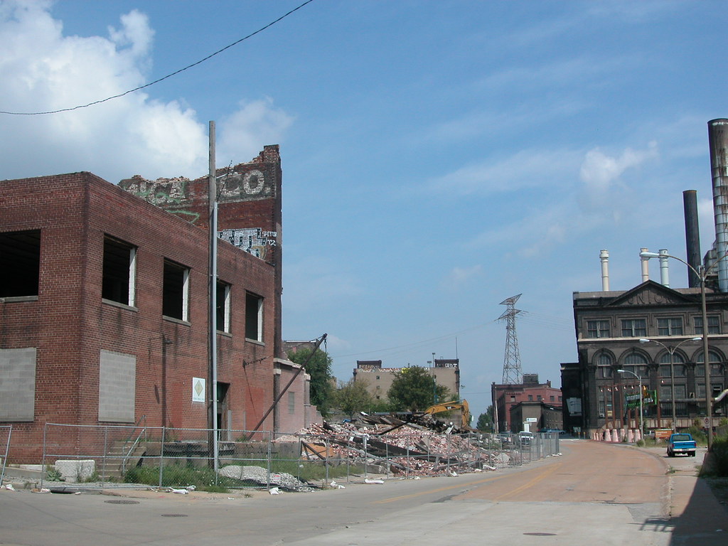
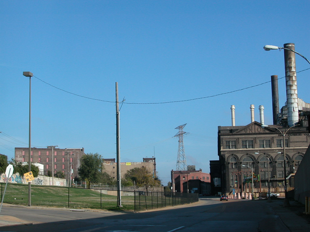
I have pushed off writing further on the now-demolished McPheeters warehouses on Lewis Street just because doing so seemed fruitless. After all, there is no way to return the important lost buildings, and little point in aggressively emphasizing the obvious -- that the demolition of the warehouses was probably city government's biggest preservation failure of 2008.
However, the more that I think about the fine original warehouse, with its adaptable mill method body, or the one-story cold storage building whose true historic significance will never be fully established, I am upset. I think about what the site looks like now, which is worse even from the perspective of the most city-fearing casino patron. I think about what we learned during the demolition: that the central 1881 building was actually built onto the city's bluff, using a natural limestone wall as part of its foundation (and the source of major water leaching into the building's timber beams, causing the west wall collapse). I think about how we could have learned from the cold storage building and figured out much about St. Louis shipping, brewing, packing and other industries. We can still learn, of course, but without physical evidence it's hard. We have lost a lot, and gained nothing.
The Land Clearance for Redevelopment Authority wrecked the buildings with public funds, but the instigator was Pinnacle Entertainment, owners of the adjacent Lumiere Place casino complex. At the city's Preservation Board, St. Louis Development Corporation Deputy Director Otis Williams -- a man with a very difficult job, mind you -- told the Board that Pinnacle feared loss of revenue without enhancement of its surroundings. The old buildings, missing roof and wall sections, had to go in the name of economic development.
Specious as this case may be on the face, there was truth inside of it. City government ought to take measures within its powers to stabilize the surroundings of businesses and homeowners who have made significant investments. In this case, LCRA was the owner of the McPheeters warehouses, and held the duty to improve the buildings.
However, there is short-term enhancement and there is long-term enhancement. Charged with the public good, rather than merely carrying out the wishes of private parties, city government has the power to challenge economic logic when it serves a singular interest and when its execution would deprive broader economic and cultural benefit. In the case of the McPheeters warehouses, rehabilitation of the buildings would have been the greater good, and demolition the lowest. All that demolition did was provide instant gratification to a large and stable company that had already made its primary investment.
In this case, city government should have taken Pinnacle's demand and raised it. LCRA could have spent comparable funds to demolition cost and used them to stabilize the western wall of the center warehouse, which had partly collapsed, and made some roof repairs to the rest of the complex. I doubt that the budget would have accomplished total stabilization, but it would have effectively mothballed them and prevented their loss.
Preservation would have been helpful to the developers and non-profit organizations that are trying to spark development in the North Riverfront Historic District. Preservation would have enhanced the scenic ride from the Arch grounds to the start of the north riverfront trail. Preservation would have allowed people to some day live or work right on the river, near downtown, the trail and even Lumiere Place. Preservation would have bridged the visual gap between Laclede's Landing and the North Riverfront Historic District, abating the impact of Lumiere Place by making it seem less disruptive. Preservation would have kept the second-nature of building materials and embodied energy in place for eventual re-use. As we know, energy and materials are valuable through growing scarcity, and their conservation is both ecologically sound and economically smart.
Obviously, Pinnacle wanted short-term satisfaction for Lumiere Place managers and guests. City government could have balanced that desire with one encompassing the desires of others, the need to safeguard the city's cultural resources and the need to enhance and spur future investment as well as safeguarding existing investment. In other words, city government could have brought planning into the discussion. Instead, it capitulated to one company's short term desire, forever removing a development opportunity for other developers or even that company itself.
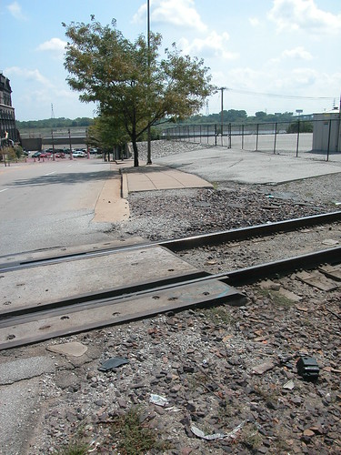
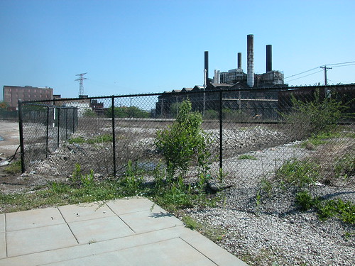
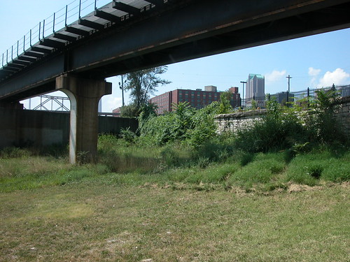
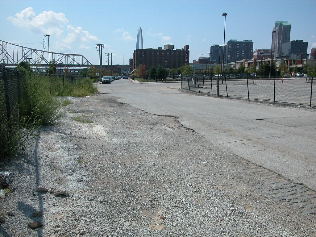
The photos below, taken during demolition, show that even the short-term effect of the demolition is not gain. While the buildings are gone, the sidewalks and streets around them are broken up, uneven and unsightly. Sidewalk and street repair here would bring public benefit, and do far more to make people think that the area is safe and healthy than demolition. I fail to see how any one's long-term desires were met by LCRA's decision to demolish the McPheeters warehouses.
 |  |
Subscribe to:
Posts (Atom)


 Posts
Posts

