We've Moved

Ecology of Absence now resides at www.preservationresearch.com. Please change your links and feeds.

Showing posts with label planning. Show all posts

Wednesday, February 10, 2010

A Positive Outcome on South Grand

Both sides of South Grand Avenue between Winnebago and Chippewa Avenues are much improved due to the diligence of concerned citizens taking effective action. Above is a photograph of the Grand South Senior Apartments at the southeast corner of Grand and Winnebago in Gravois Park, completed last year. The building introduces contemporary architecture, adds density and created several storefronts on the site of a mid-century Sears store demolished in 1994. This sort of infill is desirable and practical, and the design is not breathtaking. Why does it warrant an entire essay?

Well, this outcome was far from certain back in 2005. At that time, the site was owned by the Pyramid Companies, which had purchased the Sears site and adjacent city-owned land as part of the Keystone Place project. Although the redevelopment and blighting ordinances for the Keystone Place project outlined mixed-use moderate-density infill on the Sears site and forbade any drive-through commercial, Pyramid suddenly announced a bizarre request for a zoning variance to allow the relocation of the McDonald's franchise across the street. (The sordid details can be read at Urban Review.)

Pyramid proposed moving McDonald's to a new drive-through restaurant on the Sears site and acquiring the McDonald's site for construction of a Grand South Senior Apartments. Keystone Place residents had bought expensive new homes from Pyramid with the assurance of the redevelopment ordinance protected them from fast food across the alley. Gravois Park residents and Alderman Craig Schmid (D-20th) also were riled by the attempt to breach a redevelopment law sought by Pyramid itself just ten years prior.


What ensued was wonderful: neighborhood residents organized against the change to the existing ordinance, and were joined by supporters of sound urban planning from across the city, including young members of the Urban St. Louis Forum. Even though the boundary of his ward was the alley east of the Sears site, Alderman Schmid stood up for his constiuents' quality of life by opposing the proposed variance. Schmid attended a zoning adjustment hearing and spoke against the changes, eloquently explaining why development just ten feet outside of his ward affected his constituents' quality of life as much as anything ten feet inside. Alderwoman Jennifer Florida (D-15th), whose ward included the Sears site, chastised Schmid, but his remarks provided cover for her ultimate decision to not support the variance sought by Pyramid.


The rest became history: the citizens of Gravois Park won. But so did Pyramid, and the residents of Tower Grove South to the west. Pyramid built Grand South Senior Apartments following its original redevelopment ordinance (although by the time the first resident moved in, Pyramid was bankrupt), and the pesky McDonald's went out of business. At the end of 2009, the Mama Pho Vietnamese restauarant -- which does not serve food by drive through ordering -- opened in the old McDonald's. This block of South Grand now has a new building and a re-purposed existing building, and no annoying drive-though on either side.

Thursday, January 28, 2010

Mayor's Budget Suggestions Include Planning Cut

On January 18, Mayor Francis Slay released a list of budget changes he is suggesting to the St. Louis Board of Aldermen to address this year's shortfall. Neither any alderman or Comptroller Darlene Green released any ideas ahead of the mayor, and none has released any since. Hopefully, we won't just see a round of orders from the mayor's menu -- take this, leave that. After all, we are not discussing mere numbers but actual functions of government. The budget debate is as much about public service priorities as it is about money.

Readers of this blog will be most interested in the suggestion that the city eliminate the $130,000 annual payment from general revenue to the city's Planning and Urban Design Agency. According to the mayor's proposal, eliminating that subsidy will remove two full-time positions from the agency. One of those might be the Preservation Planner position in the Cultural Resources Office created by the Board of Aldermen in 2007. The Planning and Urban Design Agency has not even had a permanent director since Rollin Stanley's departure in December 2007.

If we actually wanted a strong, pro-active planning agency, we would need more than the current staff level. Cutting two positions to save money is a step in the wrong direction, and the savings realized minuscule. Scratch that one off the list.

Sunday, October 18, 2009

Laclede Town Remembered

Photograph from the Place and Memory Project.

Byron Kerman altered me to the fact that Laclede Town now has its own page in the Space and Memory Project database. The abandoned vestige of Laclede Town stood long enough to muddy the history of what was a noble and thriving community development experiment in Midtown.

The Laclede Town page includes an essay by Dominic Schaeffer that addresses the later perception and the early reality of Laclede Town. Here's an excerpt:

Unfortunately, the abandoned, boarded-up houses stood far too long, leaving the impression to those passing by that it must have been a failure, "the end of an error." But to those of us who were there, it was by no means a failure. Far from it.

Laclede Town's success came as much from its social architecture as its physical design. In fact, architecturally Laclede Town was fairly middling for the 1960s. What distinguished Laclede Town from other urban renewal projects was that its layout accommodated gathering places -- a coffee house, pub and small businesses. Laclede Town had a "town circle" that may not have mimicked the organically-occurring retail hubs of old city neighborhoods at least provided the sorts of uses found in them. Thus, Laclede Town mixed uses, and had a gathering place inside of its boundaries. On top of that, the legendary manager of the project, Jerome Berger, spent more time working with residents than on cutting ribbons.

The result of the arrangement was that Laclede Town's residents could actually create community -- not "community" epitomized by sterile award-winning housing towers, or community enshrined in a pretty rendering on a developer's wall, but community that was happening within the development itself. That's the type of social life that makes urban places livable. That's something that must be able to happen architecturally as well as socially. Clearly, the architecture was not the only factor, because after Berger departed Laclede Town hit its decline and eventually fell abandoned.

Thursday, August 20, 2009

Edwardsville Residents Rally for Buildings Housing Small Businesses

My coverage is a little late, but I wanted to give a shout out to the 50 people who demonstrated against demolition of historic commercial buildings last Friday in downtown Edwardsville. The Belleville News-Democrat (perhaps the region's best daily paper) has coverage here.

The bottom line: a law firm wants to demolish six small-scale storefront buildings now home to small businesses. These buildings are all historic, with some older than 100 years. However, some of the buildings were reclad or greatly altered over time. Indeed, some of them are barely recognizable as historic buildings.

However, the tenants and others oppose the move not just because these buildings are old. The opposition stems from recognition that downtown Edwardsville needs buildings like these to retain small business and vital street scapes. Giant new office buildings take away not only the low rents that foster commerce, but the differentiation in a block face that makes it a welcoming environment. Preservation here is not essentially about saving something old, or something pretty, but something that encourages a mode of business conducive to building community. Maybe someday someone will restore the facades of these buildings, but even if that never happens the buildings are working just fine.

Downtown Edwardsville's commercial district has seen a resurgence of small business activity, and retaining storefronts is essential to future growth. Like many downtowns, Edwardsville's has plenty of surface lots where a new office building could be built. There is no reason why the lawyers seeking their own building and the small businesses cannot coexist.

Monday, August 17, 2009

St. Charles County Preserving Open Space

A story from Saturday's St. Charles County Journal, "Green acres: Couple donate land for park," by Kalen Ponche, caught my eye. St. Charles County residents Dave and Mary Jane Wolk did not want their 67-acre property to be subdivided, so they are donating it to the St. Charles County Parks Department for eventual park space. According the article, the Wolks' land is not the only park acquisition in the immediate future:

The county plans to spend $3.34 million for a 60-acre property owned by Robert J. and Patricia Day Barnard and a contiguous, 115-acre property owned by New Melle Lakes Development Co. and Apted-Hulling Inc.

(Anyone else surprised to see Apted-Hulling still around?) Besides these sizable acquisitions, the parks system in the county has received other donations from concerned families:

The Wolks are the fourth family to donate land to the county park system. Two of those donations are parks in reserve - 91 acres northwest of O'Fallon donated by Dolores Freymuth, and 100 acres south of Highway 364 (Page Avenue extension) and west of the Missouri River donated by Bill and Nancy Knowles. Officials hope to open the Old Boyd Plantation and Towne Park, donated by Betty Towne, next year.

The St. Charles County Parks Department now owns 2,855 acres and hopes to own 4,000 acres by 2015. These numbers are encouraging. If the past 25 years were years where St. Charles County leaders aggressively pursued development of rich farm land, maybe the next 25 will be years of sensible land conservation. As growth declines in that county, the time is right to safeguard land.

Sunday, August 9, 2009

Can St. Louis Lure Small Businesses?

This week New Geography published an interesting article by Steve Null entitled "New York City Closes Shop". The article reports that under the anti-small business policies of New York City Mayor Michael Bloomberg, over 83,000 small businesses have been forced to close since 2001. That astounding figure represents just the recent effort to "crack down" on commerce that predecessors Rudy Giuliani, David Dinkins and Ed Koch all enforced as well.

Has this trend pushed small business out of the Big Apple? If so, what can smaller cities do to lure some of the entrepreneurs that might end up looking for a more encouraging urban business environment?

While Chicago has been a beneficiary of New York's terrible policies, St. Louis could lure some of the business. St. Louis has an abundance of historic commercial districts, where old buildings offer cheap rents and low purchase prices. Small business owners can afford to rent a small space in New York and maybe an entire building in Chicago. In St. Louis, they can buy a building -- or two. The low cost of living is a base incentive.

The 8200 block of North Broadway in the Baden neighborhood, 2006.

However, St. Louis needs more than a low cost of living and old buildings to draw businesses from larger cities. We need better urban planning policies to promote commercial districts by retaining storefront buildings and keeping out fast food, drug stores and other uses that break up urban streetscapes needed to draw shoppers. We need public sector investment in infrastructure like sidewalks, alleys and lighting. The business license fees and sales tax rates in the city are too high, especially on food and drink. Most of all, we need to break down the ward-by-ward differences in business and license policy with strict citywide standards that make sense to people from the outside world.

I'm not suggesting that a wave of would-be New Yorkers are coming. In fact, many of the small business owners we need to attract are those who chose Clayton, St. Charles or Belleville -- or Memphis, Cleveland or Kansas City -- over the city proper. The bottom line is that we have to create a city that not only has sensible small business policy but actively encourages small business to keep our neighborhood commercial districts thriving.

I would be very interested in comments from city small business owners.

Thursday, July 30, 2009

From Done Deal to Dead Deal?

Next American City has an article by Katherine Mella entitled "Atlantic Yards: A Crash Course" that provides a great overview of Forest City Ratner's controversial Brooklyn mega-project centered around a new sports arena.

The supposedly "done deal" project was pushed through at the state rather than local level to head off opposition. Aggressive agents made over-market-value offers to secure control of key property around desired public land (underused Metropolitan Transit Authority rail yards). Atlantic Yards bolstered political support by lining up labor leaders, clergy and others who typically might oppose a large project and mass use of eminent domain. To woo the urbanist community, Forest City Ratner hired superstar architect Frank Gehry to design the complex. Residents who would be pushed out by the project have always had an uphill struggle.

There are many parallels to the NorthSide project. However, one thing about Atlantic Yards that we have not seen with NorthSide is a political swing in favor of opposition. Mella's article concludes by noting that Atlantic Yards has lost much of its initial advantages:

Being able to borrow money and raise capital in this fiscal climate has placed the project at a severe disadvantage. And with a less than exciting main attraction, resolute local opposition, and legal and financial hurdles, it is hard to say if Ratner's Atlantic Yards will ever -- or even ought to -- come to fruition.

I suppose the perils of large-scale development have never been as clear as now. Atlantic Yards may have killed itself through sheer folly of its ambitious scope and clumsy execution. The development team behind NorthSide should take heed.

Sunday, July 26, 2009

Medical Center Creeping Into the Central West End

Ecology of Absence 
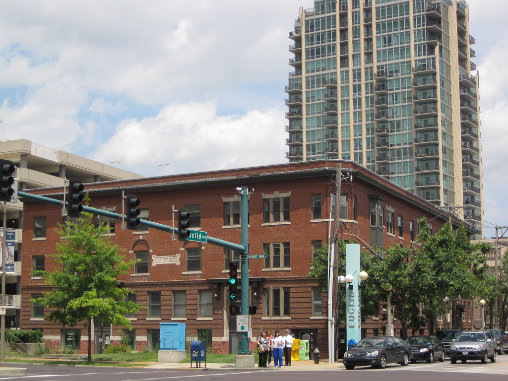
has long covered the creep of the BJC medical center into surrounding urban fabric. Now we look at a (hopefully) rare instance of the corporation extending its reach north of the Forest Park Parkway into the southern end of the Central West End. Euclid's pedestrian-friendly streetscape has long been an antidote to the medical center's monotony, but now the architectural characteristics of each area will collide.

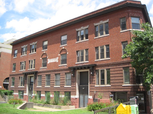
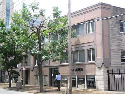
On Monday, the Preservation Board will consider on a preliminary basis demolition of the Ettrick (shown above) and three other buildings to make way for a new 12-story clinic building at the corner of Euclid and Forest Park as well as a new park further west. (Read the Cultural Resources Office staff report here.) Since the Cultural Resources Office (CRO) staff is strongly supportive of the demolition, and many urbanists seem comfortable with the new building, approval may be a foregone conclusion. Still, I think that preserving the Ettrick deserves more consideration. The current plan was enshrined in 2007 by the Board of Aldermen through Ordinance 67939, so the demolition plans are not news. However, a rush to approve the concept and the related park plan would be a mistake on the part of the Preservation Board.

The Ettrick is one of the city's oldest apartment buildings and dates to 1905. A. Blair Ridington, an English-born architect and amateur Egyptologist who designed the Melrose Apartments at 206 N. Sarah (1907) as well as many houses across the city, designed the Ettrick. (Ettrick, by the way, is a region on the Scottish borders containing a large forest.)

Construction of the Ettrick was part of a trend toward the relatively-new apartment-style building for multi-family middle class housing. Previously, most people lives in tenements, which are so defined by having separate exterior entrances for each unit. Apartments provided elegant foyers and enclosed staircases. Within a year of the Ettrick's completion, the first luxury apartment building, the Colchester (later dubbed "the ABCs"), would be built a block away at Kingsighway and Laclede.

The Cultural Resources Office claims that getting the Ettrick listed in the National Register of Historic Places as a single site would be difficult, but overlooks the fact that the later Melrose and Colchester were easily listed. The Ettrick is much more significant to the development of the apartment building and Ridington's career than the Melrose.

The Ettrick's style is decidedly Craftsman, and its details are lovely. The Flemish bond masonry, the use of cut stone, the hoods over the entrances -- all provide expression of the building that is elegant as well as humane. The details are sized to the scale of the human hand. People often comment on the awkward below-grade entrances; these were created later when the raised lawn was removed and the basement converted into commercial space. The original design was more satisfying and in keeping with the setback and lawn shape of Forest Park.

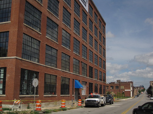
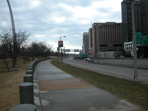
Across Forest Park Parkway from the craftsman-detailed Ettrick stands a cavalcade of sanitized, machine-scaled giant buildings. BJC has done much to build up its campus, but little to address the life of the pedestrian.

I suppose that the medical center is the domain of its employees, patients and vendors, rather than an extension of the neighborhood. However, the Central West End MetroLink station lies just a few yards south of this intersection. Crossing Forest Park here is like leaving St. Louis and entering Campus Anywhere, USA. A few vestiges of the historic medical center remain, but the new architecture generally rises only to the level of need and no further. (The Siteman Center is an exception in form, although not in material.)

At any rate, transpose the medical center scale with that of Euclid Avenue to the north, and one sees exactly what the stakes are: architecture that reaches out to human beings could be wiped out for architecture designed by computer modeling, equations and corporate intelligence. The new building's street-level retail simply is a programmatic improvement over the historic buildings that occupy the site.

The joined apartment buildings to the north of the Ettrick, alas, have been marred by re-facing and infill. These buildings date to 1905 and originally set back from Euclid with front lawns. The rise of the first floor above the sidewalk indicates that this was not originally a mixed-use building. If the storefronts below sidewalk level feel like basement space, that is because they are.

While the loss of a usable building is regrettable, this is one building whose future is negotiable. If BJC wishes to take it down to building something more urban, let it. However, let the new design be every inch original, and let the skin be other than "rental tan" concrete panels and teal-tinged glass. The Park East Tower has already introduced a new scale to this stretch of Euclid, and that is fine, but that is no reason to surplant the existing character wholesale. Hopefully BJC's clinic is the last incursion north of Forest Park Parkway.

Even in its current state, this muddled old building has more heart and soul than much of the new construction that BJC has built in the last 30 years. Demolition in favor of a building that is architecturally sensitive to Euclid and its pedestrians -- no matter how tall -- would be a positive change. Demolition for another unmemorable hospital building -- in a nation chock full of them, no less -- would be a detriment.

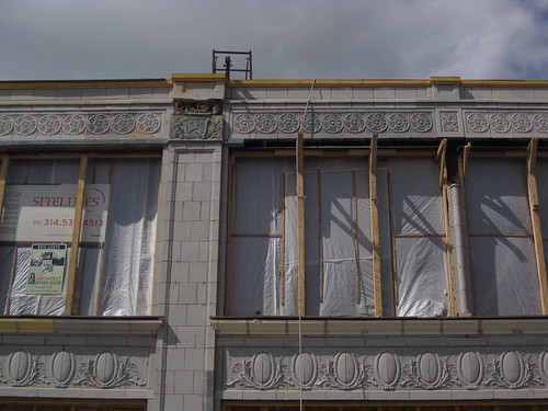
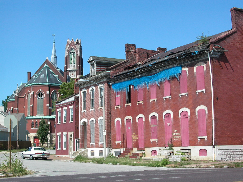
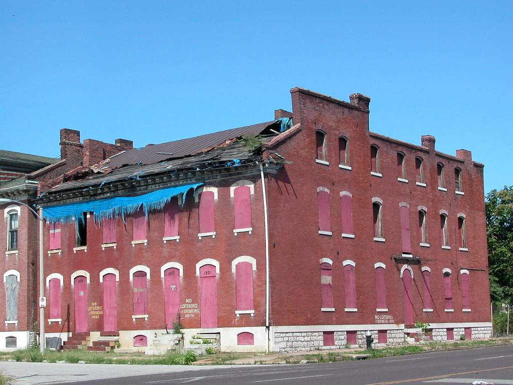
The other part of the application to the Cultural Resources Office is demolition of the Schoenberg Residence Hall at 4949 Forest Park, west of the abysmal parking garage west of the Ettrick. This fine, restrained work of Georgian Revival design would be replaced by park space. Jewish Hospital, whose building on Kingshighway BJC plan to preserve, built this building in 1934 as a residential hall for its student nurses.

CRO Director Kathleen Shea errantly states in her recommendation to the Preservation Board that there is no possible way to stage construction of the 12-story clinic building without demolition of this building first to create a staging site. Shea's claim is undercut by countless instances of high-rise construction within the restricted core of downtowns across the country, from Chicago to Des Moines. Closure of Forest Park and Euclid are impossible, of course, but there are numerous ways to stage the project without demolition of Schoenberg.

The urban voices who do not share my view on the Ettrick seem united against demolition of Schoenberg. The replacement of a viable building with a viable building is contested territory, but the replacement with empty space is not -- as the San Luis Apartments effort demonstrates. The absurdity of creating a new park a half-block from Forest Park is obvious, and the Preservation Board should deny the demolition of Schoenberg no matter what its majority thinks of the other two demolitions.

Generally, the land use planning here is spotty. BJC owns much vacant land and surface parking, including frontage on Forest Park Parkway. There seems to be a way to preserve either or both the Ettrick and the Schoenberg Residence Hall while building the new clinic. Why does the Preservation Board only now get review of a plan approved by ordinance in 2007? Well, the preservation ordinance does not authorize preservation review of redevelopment ordinances even though those ordinances often bind the CRO and the Board. Of course, the city needs more sensible urban design laws that would coordinate decision-making rather than hand off deals to the Preservation Board.

Still, this is no done deal, at least under the preservation ordinance. Let's see what happens Monday.
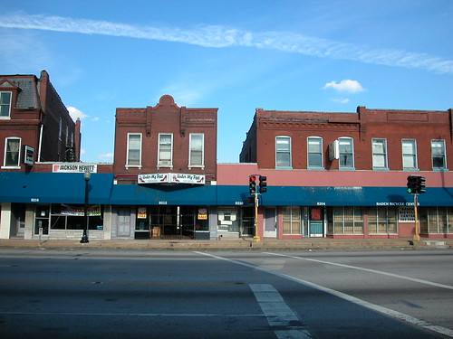
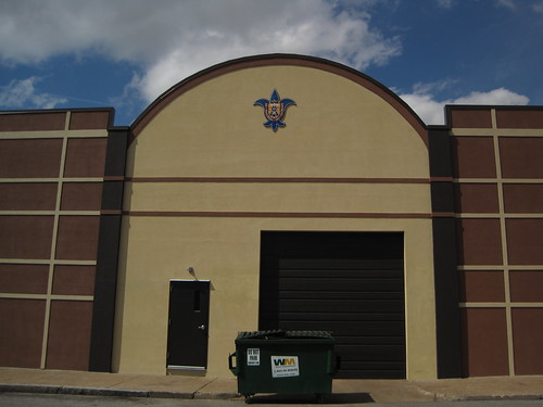
Wednesday, July 1, 2009

Good and Bad on Locust Street

The PW Shoe Lofts project is heading toward completion at the northeast corner of Locust and Theresa avenues in the emerging Locust Street Business District. The project is an exciting step in the connection of the Grand Center district, with its large institutions and emphasis on arts, with the Locust Street area, a more organic mix of pedestrian-scaled development. The PW Shoe Lofts is the connector between the two area, and its occupancy will do a lot to help bridge an abrupt gap.

When complete, there will be 33 loft apartments inside of the former Pedigo-Weber Shoe Factory. Albert Groves, architect of the Masonic Temple, the front buildings at City Hospital and other buildings, designed the plain, handsome building, which was built by Murch Brothers and completed in 1918. (The one-story addition dates to 1948.) The Zane Williams company, former occupant, hired Renaissance Development to develop the building and Garen Miller to design the rehab. One of the best parts of the project is that the 33 units will be served by only 15 internal parking spaces, so the project does not create too much new parking in an area that has excessive supply. The end result will be a cool, urbane housing option near St. Louis University.

However, there are a few urban design problems on this end of Locust Street. Beside the blank back wall of the Moto Museum across the street, there is a bigger gulf here: the space immediately east of the PW Shoe Lofts.

East of the PW Shoe Lofts is the vacant lot where once stood a fine two-story livery stable. St. Louis University demolished the building in 2007, after it was included in the National Register of Historic Places as part of the West Locust and Olive Streets Historic District. In the place of the livery stable, built in 1885-1889 and later remodeled as an automobile dealership, stands a pernicious auto-related use: a seldom-used parking lot serving Chaifetz Arena. East of that lot, the university and Alderwoman Marlene Davis )D-19th) vacated Josephine Baker Avenue to create an even larger urban gulf between the vibrant end of Locust Street and Midtown.

Moving east, we have a fine row of four historic buildings -- two of which are owned by St. Louis University, which promises eventual rehabilitation. These are the two at left in the photograph above. At very left is a fine, broad-front automobile sales building built in 1914 and designed by Clymer & Drischler (3331-9 Locust Street). To its right is an older three-story brick building with a fine iron fire escape on its front elevation (3327-9 Locust Street). Designed by Godfrey Hirsch, this building started life as a carriage repository owned by Joseph Long. These buildings are vacant.

The other two buildings in this row are in active use. There is the refaced building with a modern front at 3323 Locust Street, first built in 1891 but altered later to keep up with the demands of tenants trying to hawk cars on Automobile Row. Its more iconic neighbor at 3321 Locust Street is the firehouse-like Underwriters Salvage Corps No. 3 building, built in 1892 and designed by K.S. Evans. That building serves as a private residence.

All in all, these four buildings showcase a breadth of age, height, material and storefront treatment common in a historic commercial district. The variety is held together by the common vocabulary of human-scaled materials and ample fenestration.

What impulse compelled St. Louis University to place a windowless monster next to these four buildings? While the university's new library warehouse is essentially a remodeling of a building that had long lost its windows, the completion was earlier this year. The university had the choice to place this warehouse in many locations, and it chose a pivotal connecting block in a commercial district trying to renew itself. Wealthy St. Louis University could have funded any number of architectural programs on the important Locust Street elevation, but it chose to go with a forbidding, bland EIFS wall interrupted only by utilitarian steel entrance and garage doors.

Plainly, the warehouse is a disruptive force in the Locust Street Business district. The placement of dumpsters in front on the building on Locust is yet another failing. Here, the university could have invested in the pedestrian scale of Locust Street, and instead it bluntly subsumed the commercial district to its own utility -- just as it did with the livery stable demolition.

Meanwhile, two blocks east, Renaissance is working on the old Kardell Motor Company Building at 3141 Locust Street and an adjacent United States Tire Company building at 3147 Locust Street. Once covered by a nasty slipcover, the old showroom's fine glazed terra cotta has been restored. The Kardell Motor Company Building dates to 1916 and was designed by Preston J. Brashaw, while the United States Tire Company Building is the work of Stephens and Pearson. Bradshaw's mastery of ceramic expression is concentrated here, while in larger works like the Chase Hotel, the Paul Brown Building and the Coronado Hotel it is more diffused through large brick masses. The Kardell building is an architectural cream puff, and its restoration is testament to the vision of Renaissance and other parties working to revive Locust Street.

On one block, a developer is going so far as to remove slipcovers and restore damaged terra cotta. On another, there is a new faceless warehouse. Such contradiction cries out for resolution through a sensible master plan. Much of Locust Street between Jefferson and Theresa is now listed in the National Register of Historic Places. How about design guidelines for new construction as well as rules and restraints on parking for a next step?

Monday, June 29, 2009

City Hall Asking Right Questions about McEagle Project

Friday's St. Louis Business Journal carried two stories on McEagle's NorthSide project that quoted Deputy Mayor Barbara Geisman and Mayoral Chief of Staff Jeff Rainford. (Articles are available online only to subscribers.) The primary article, "Will Paul McKee and City hall bond?" dealt with the developer's request that the city guarantee via general revenue half of the $410 million in tax increment financing bonds sought. From the comments in the article, it sounds like City Hall is not ready to roll over on the request.

Rainford says that Mayor Francis Slay is skeptical on the city backing the bonds, and that Slay will only do so under "extraordinary circumstances." Rainford acknowledged ongoing negotiations between the mayor's office and McEagle, but the article did not elaborate on what "extraordinary circumstances" would be.

Deputy Mayor Geisman went further, stating that the city doesn't know enough about the project yet to consider a request for general revenue backing. The article ends with a frank -- and encouraging -- quote from Geisman: "Lots of people ask for lots of things; it doesn't mean they're going to get it."

While there is much to admire in the scope of McEagle's vision as it has been laid out, the TIF request is abrupt and based on unsubstantiated financial information. The size of the request alone raises questions, but the push for city backing is premature. As the Business Journal article notes, the only three times when the city backed TIF bonds -- St. Louis Marketplace, the convention hotel and Pyramid's acquisition of One City Center -- the city has ended up on the hook for failed or troubled development projects. McEagle has yet to demonstrate that its project would be any different.

I am heartened that City Hall has shifted gears from largely favorable comments to on-point comments. Hopefully this indicates a stance of tough bargaining, because a city that is eliminating jobs and implementing furloughs cannot afford to throw the treasury open for an untested vision.

That said, the second article, "McKee eyes land swap with MoDot for first phase," showed some of the possibilities of the McEagle development. McEagle wants to eliminate the 22nd street ramps and use that site for new office development, and it seems that City Hall favors that approach. Readers know how much I want City Hall to support eliminating needless highway components, so I am glad that Geisman seems positive about removal of some of the most useless highway infrastructure in the region.

I have little to complain about the 22nd Street part of the McEagle vision: it removes useless and divisive infrastructure, adds density, does not affect any houses, businesses or historic buildings and it could result in a termination of the visually-challenged Gateway Mall other than a chain link fence. McEagle wants this to be the first phase -- why not separate this area out into its own redevelopment area with its own enabling legislation?

One major problem with the McEagle project has been the lack of public-side planning. If city government was vigilant about setting and enforcing urban planning goals, the McEagle project would conform to those objectives and not be as problematic as it has been. Barring real planning, City Hall ought to use its powers to make sense of the project for the benefit of the city. Beyond the TIF deal, City Hall should look at the possibility of breaking the project down into smaller redevelopment areas, creating real historic preservation planning and placing the promises unveiled on May 21 into an actual contract between the city and the developer. A good deal is possible, and City Hall is at the center of that.

Sunday, June 28, 2009

Taxes and Urban Rot

The following essay by W. Philip Cotton, Jr. appeared in the volume "Laclede's Landing" Area, published by Landmarks Association of St. Louis in 1968. When I first unexpectedly found this essay tucked in a booklet on Laclede's Landing, I was impressed by Phil's astute observations on taxation policy and its relationship to preservation of historic neighborhoods. In 1968, in the era of wide admiration of singular works of architecture, this line of preservationist thought was truly progressive. Phil's words on the use of government incentives are prescient. Yesterday, at a memorial service, we celebrated Phil's work and contributions. I wish to again state that his legacy is worth the consideration of today's preservationists. -- MRA

Taxes and Urban Rot
by W. Philip Cotton, Jr.


Wrong methods of taxation are a fundamental cause of urban decay. One might ask what taxes have to do with landmarks? For landmarks thought of in the narrow sense of isolated buildings the question is not so significant, but for landmarks of the urban environment, districts and sections which are the essence of a great city, taxes are highly significant. It is necessary, at times, to go beyond the confines of a specific concern or interest to get at fundamental components or problems.

The first sentence above states that "wrong methods" of taxation are a root cause of decay and slums in cities. The principle word is "methods." The amount of taxes is not necessarily the determining function, but, rather, the way they are raised profoundly affects the state of health of the city. The old tax on windows in England had an obvious effect on the number of windows in a building. It is easy to picture that this method of raising the necessary revenue had at some point a deleterious effect on public health, as many habitations would be without sufficient light and air.

Our present policies of taxing land and improvements (with the greater portion derived from improvements) have recognizable effects: slums are the most profitable housing investments, not because of any inherent attractiveness of slums but because of tax policies. For letting buildings decay one is rewarded with lower taxes; on the other hand, improvements are penalized with higher taxes. Decay spreads faster than we can treat its symptoms, which we usually do with one or more government programs. There is little chance of fundamental improvement or reform from within our government; it can come only from an aroused citizenry which is aware of the fundamentals of cause-and-effect economics as distinguished from social-reform economics.

Another great obstacle in the way of fundamental reform of taxation is the implicit belief in the Eleventh Commandment, "Thou shalt not rock the boat." -- even if by rocking, the boat be saved from sinking. For many this is a greater imperative than the other ten.

As long as slums provide a higher economic return on investment than well maintained housing, the various government appeasement offerings serve only to reward the slum owners and temporarily pacify slum inhabitants. "More than fifty years ago Lloyd George warned the British Parliament that 'low rent public housing bills will never be effective until you tackle the taxation of land values.'"* In 1960 the Mayor’s Special Committee on Housing in New York City reported, "The seemingly unstoppable spread of slums has confronted the great cities of the nation with chronic financial crisis ... The $2 billion public housing program has not made any appreciable dent in the number of slum dwellings ... No amount of code enforcement ... will be able to keep pace with slum formation until and unless the profit is taken out of slums by taxation."*

The idea of taxing land values and not taxing improvements is neither new nor untested theory. Where it has been fairly tried it has produced effects which can readily be observed and evaluated. Brisbane, Australia has not had taxes on improvements since 1896; it taxes only the unimproved value of the land. Colin Clarke, economist at Oxford University, who lived in Australia for twenty years writes of Brisbane that it is "the only great city in the world without a slum."*

The restraining effects of taxes on improvement in St. Louis are so great that to stimulate major new construction in the city it is necessary to use the Missouri Redevelopment Act making it possible to give a near exemption from property taxes for a decade or two. This subsidy at the expense of all other property owners (and taxpayers in general) is necessary to attract new investment in improvements. Why not give, in effect, a subsidy to all who improve and maintain their properties by untaxing improvements and taxing only the value of the site location which is created by public improvement and population rather than giving the subsidy to a few?
Private enterprise cannot solve the housing problem and other problems of the urban environment as long as the profit motive is harnessed backwards. Until there are financial incentives for improving and maintaining property and thus, in effect, penalties for decay and rot, there is no hope for substantial improvement.

The fundamental answer to the problem is not charity without tax reform. Winston Churchill writes, "...a friend of mine was telling me the other day that, in the parish of Southwark, about 350 pounds a year was given away in doles of bread by charitable people in connection with one of the churches. As a consequence of this charity, the competition for small houses and single-room tenements is so great that rents are considerably higher in the parish! All goes back to the land, and the land owner is enabled to absorb to himself a share of almost every public and private benefit, however pitiful those benefits might be." So the rot was then and so it will remain until we stop subsidizing slums and penalizing well maintained property by out ill-conceived tax policies.”

* "Taxes and the Death of Cities" by Perry Prentice. Architectural Forum, November 1965.

Friday, June 19, 2009

One of the Central West End's Parking Lots

The 1.48-acre parking lot on the southeast corner of Euclid and Delmar is a great reason not to allow construction of another parking lot in the Central West End.

In the late 1970s, the non-profit Union-Sarah West Economic Development Corporation demolished a row of vacant commercial buildings here to build the lot under the guise that the parking lot was necessary to serve the renovated Euclid Plaza Building. Today, the lot sits vacant. Not only is the lot closed off to public use, it is never used at all. The parking lot is weedy and blocked off. The Roberts Companies have proposed new construction on the site, but nothing is current in the works.

While the fate of this lot and the fate of any lot built by the St. Louis Archdiocese cannot be compared -- the Archdiocese will be a good steward of a new parking lot, I am sure -- this lot raises a planning question. Does a neighborhood with so many underutilized surface parking lots at prime corners need another?

Wednesday, June 10, 2009

Six Ways to Remove a Freeway -- How About Seven?

Six Case Studies in Freeway Removal is a an excellent overview of successful efforts to eliminate interstate highways in urban areas that created barriers. While there are examples from large cities like San Francisco, Toronto and Vancouver where one might expect progressive government, there are also studies from Milwaukee and Chattanooga where advocates for reconnecting the urban fabric faced greater odds.

There are constant themes in each project profiled in Six Case Studies in Freeway Removal: beautification and functionality were major goals of cities that removed freeways or freeway sections, spillover traffic was absorbed without major new congestion and freeway removal almost always lead to higher property values. St. Louis leaders contemplating the mess at the western edge of the Gateway Arch grounds ought to consider the findings of this study, and commission one aimed at the particular local problem that I-70 poses.


One of my first reactions to the case studies from other cities is that the I-70 problem is not that big. Taking the logical dimension of removal from the Poplar Street Bridge on the south to Cass Avenue on the north, one sees that we don't have as long or as vital a stretch of highway as other cities removed. What we will have in a few years, after the new river bridge opens, is a redundant second section of an interstate highway that disrupts the connection between downtown and the riverfront.

Is St. Louis ready to join the ranks of the cities that have found the leadership needed to think big? A few months ago, I might have been pessimistic. Now, I see that City Hall and many leaders are willing to take a major urban planning risk with McEagle Properties' NorthSide project. Putting aside the details of NorthSide, that project takes a leap of faith -- the scope is vast, the cost great and the potential for changing the central city tremendous. Part of the project even involves removing interstate highway infrastructure, the 22nd Street ramps connecting to Interstate 64. The project aims to capture southbound I-70 exit traffic and send it onto Tucker Boulevard, not eastward toward Memorial Drive. That flow could lessen traffic volume on the old I-70 and Memorial Drive.

Is there a connection between NorthSide and removal of I-70 downtown? Not yeat, but there is a binding tendency in each project: big-picture economic development planning. While NorthSide's proponent is its developer, proponents of removing I-70 are citizens who see tremendous development opportunity along a human-scaled street. The removal of I-70 would weave the riverfront back into downtown, and it would create acres of land ripe for transformative downtown development. Like NorthSide, the process could take decades, but the results would be redevelopment on a scale beyond our wildest dreams. Add in the Chouteau Greenway project, and in thirty years Downtown could be ringed not by bleak interstate, asphalt parking and towing lots and vacant buildings but by connections to exciting new projects and renewed old neighborhoods.

Other cities took the leap of faith needed to set this level of vision into motion. Will St. Louis?

Monday, May 25, 2009

Looking Back at Gateway Village

To some people, the current discussion about McEagle's "NorthSide" project has roots in a project proposed for the same area 13 years ago: Gateway Village. Like "NorthSide," Gateway Village involved a close relationship between a mayor and a private developer from outside of the city, proposed massive demolition, proposed eminent domain and large public subsidy. Unlike "NorthSide," however, Gateway Village never moved close enough to reality to disrupt the section of St. Louis Place it would have wiped out.

In 1996, Mayor Freeman Bosley, Jr. unveiled his grand plan for revitalizing north St. Louis: a 180-acre golf course and subdivision called Gateway Village that would use the Pruitt-Igoe site as well as the western part of St. Louis Place. The boundaries were Martin Luther King Drive on the south, 20th Street on the east, St. Louis Avenue on the north and Jefferson Avenue on the west. The plan called for building 781 new homes (priced out of range of most St. Louis Place residents) and a 9-hole golf course (designed by renowned designers Don Childs Associates) platted for very low density at odds with surrounding historic city fabric. Going against neighborhood sentiment in an area where he had tremendous political support, Bosley supported the acquisition of 209 residences and six businesses to clear the project site.

The developer behind the project, whose identity was unveiled after the first announcement, was Waycor Corporation of Detroit. Waycor's president was Don Barden, a wealthy Detroit businessman who has since gone on to become a major casino owner. At the time, Barden was the owner of television stations who had never developed a project on the scale of Gateway Village. Also in 1996, the Federal Election Commission determined that Barden has co-signed an illegal loan to a Detroit Congresswoman.

Whatever his inexperience and lack of ties to St. Louis, Barden gained the confidence of Bosley, Jr. and Maureen McAvey, the director of the St. Louis Development Corporation. Unlike today, where McEagle is unveiling its own plans, in 1996 Bosley and McAvoy did the public relations work for the developer. In August 1996, McAvoy released a study by Don Childs Associates that predicted that Gateway Village would be feasible and successful. The city paid the architects $38,000 for a study that championed a project in which they had a financial interest.

The study predicted that Gateway Village would precipitate "a return to living in major metropolitan cities" and that it would "act as a catalyst to revitalize the area." The Greater Pruitt Igoe Neighborhood Association, which is now defunct, rose up against the plan to safeguard the 209 homes sought for condemnation and demolition.

In October 1996, the city government requested a $8 million grant from the United States Department of Housing and Urban Development toward the project. The total project budget was $127.5 million, an amount fairly low for such a large area. The low cost was indicative of low density construction and low construction standards. Of course, $8 million was not the only handout sought by Waycor. Waycor wanted an additional $35 million in public financing. Waycor would not commit any of its own capital unless it could secure public money first -- also different than the current situation.

The feasibility study commissioned by the city outlined the path toward development, with step one beings "complete agreement with Waycor." That step was removed after the St. Louis Post-Dispatch discovered that the city had commissioned a development feasibility study that not only recommended a certain developer but indicated that an agreement was already being created.

The Greater Pruitt Igoe Neighborhood Association sent a letter to HUD Secretary Henry Cisneros asking that he deny the $8 million grant request. Shirley Booker was one of the authors of the letter and very active in organizing St. Louis Place residents. Vernon Betts was one of a few St. Louis Place residents who gave favorable comments about Gateway Village to the press, but the majority of residents were opposed.

Bosley's response to the Greater Pruitt Igoe Neighborhood Association's letter is classic and timely: "It's unfortunate that a small group now want to try and thwart the one thing that can work."

In development, there always seems to be "the one thing that can work" -- what the person using that phrase wants to do.

An aldermanic election for the Fifth Ward, where the project was located, came in spring 1997. Veteran Alderwoman Mary Ross was retiring. In the race to succeed Ross, Democratic candidates April Ford-Griffin and Loretta Hall supported Gateway Village, and John Bratkowski was adamantly opposed. Ford-Griffin, whose support was for the project was not staunch, won the seat. At the mayoral level, Bosley lost the Democratic primary to Clarence Harmon.

Even before he took office, Harmon announced his plans to pull city government out of the Gateway Village project. On April 4, 1997, the Post-Dispatch published an article entitled "Harmon: 'Dead Stop' for Golf Course Plan," that covered the mayor-elect's opposition to a project that would lead to the dislocation of city residents. McAvey retorted that the project would bring the middle class back as well as retail for low-income residents.

Harmon's move coincided with HUD's denial of the city's request for funding. Shirley Booker explained neighborhood opposition well. Residents wanted development, she said, "just not a golf course. We can't keep existing with all this vacant land. The Lord didn't mean for it to be like that. It's a waste."

McAvey clung to Gateway Village, though, telling the press that no one would be able to develop St. Louis Place without large public subsidy and amenities provided. Her tenure would end shortly thereafter. Ford-Griffin learned a few lessons from Gateway Village and spearheaded an often rocky but productive community-based planning process leading to the Fifth Ward Master Plan, published in 2000 although not fully adopted by the Board of Aldermen.

Harmon, of course, showed little leadership on development issues, but his decision to pull the plug on Gateway Village allowed for the kindling of small-scale development on the near north side. Many leaders learned very little from the Gateway Village experience and continued to bemoan the lack of a large scale plan for the area around Pruitt Igoe. Bosley, Jr. himself is now a backer of the McEagle project, seen occasionally accompanying Paul J. McKee, Jr. at meetings.

One of the problems with the Gateway Village debacle and the resulting Fifth Ward Master Plan is that there was no strong legislative result. The threat of a large-scale plan in the Fifth Ward remained because there were no basic protections against that mode of development. Zoning and land use recommendations were never implemented as law, historic districts and sites were not identified and listed in the National Register of Historic Places, and redevelopment zones that would have broken the ward into smaller pieces were not created. The Fifth Ward's biggest problem in recent years is the large amount of vacant city-owned land -- quite a big prize to lure developers. Without safeguards against large scale projects, the ward has been left vulnerable to the supersized visions that Gateway Village illustrated.

Tuesday, March 17, 2009

Landmarks Association Comment on JNEM Management Plan Calls for Better Connections

Landmarks Association of St. Louis submitted the following comment on the draft General Management Plan for the Jefferson National Expansion Memorial to the National Park Service:

Landmarks Association of St. Louis, Inc. was founded in 1959 with a mission to "promote, preserve and enhance St. Louis' architectural heritage and encourage sound planning and good contemporary design." Both facets of our mission statement compel our comment on the draft General Management Plan (GMP) for the Jefferson National Expansion Memorial (JNEM).

Generally, we find that the GMP includes many strong and useful ideas for a future design program that would preserve the unique modern landscape of the Arch grounds while transforming the connections between the landscape and surrounding urban fabric. Landmarks Association commends the National Park Service (NPS) on recognizing the extent to which the condition of the existing connections are a hindrance to both JNEM and downtown St. Louis. We are supportive of many of the ideas common to all of the Alternatives under consideration, including streetscape unification plans, improvements to interpretive programming and museum exhibits, increased visitor activities, improved pedestrian access and encouragement of development of the east riverfront.

True to our mission, Landmarks Association makes the following recommendations for the final GMP to clarify preservation of the Arch grounds and expand the range of possible options for improving connectivity:

1. The NPS should allow removal of I-70 in the GMP. The presence of I-70 at the western edge of the Arch grounds is the biggest obstacle to pedestrian access, at the Old Courthouse, Washington Avenue and other major entrance points. With the projected opening in 2012 of a new Mississippi River Bridge carrying I-70, the elevated and depressed lanes that sever the Arch grounds from downtown will no longer be necessary interstate lanes. One possibility at that time would be exploring a merger of I-70 and Memorial Drive into an attractive at-grade boulevard that would carry through traffic while creating a softer, pedestrian-friendly western edge to the Arch grounds. This idea could be explored through a design competition and traffic study. The current GMP alternatives would not allow exploration of this idea. The final GMP should include removal of I-70 within the parameters of a design competition.

2. The GMP should contain other options for a design competition. The NPS has included in the GMP alternatives a detailed and comprehensive understanding of the problems and opportunities of improved access to the Arch grounds. The preferred alternative calls for a major design competition for resolution of these issues, but we think that NPS has already created a framework for practical, incremental solutions. We think that a major design competition has the potential to generate design ideas incompatible with a landscape designated as a National Historic Landmark containing an iconic work of modern architecture. Division of the competition into phases based on specific areas where there are access problems could allow for an incremental implementation that resolves design problems faster and preserves the integrity of the JNEM landscape. An incremental approach would also allow time to build needed alliances with public and private entities that control infrastructure crucial to improved access but not contained within JNEM. The GMP should not bind the process to a single major design competition.

3. Site history must be part of program expansion. The St. Louis riverfront was the entry point into the city for nearly 200 years. The riverfront's architectural, commercial and cultural history is key to understanding the significance of the JNEM site, and current interpretive program could be expanded to better tell that story. Architectural elements and artifacts from the riverfront could be prominently displayed in existing or new JNEM cultural facilities or made part of new construction.

4. The GMP should improve access and connections at all sides of the Arch grounds. The current GMP alternatives are weighted toward improvement of access at the western side of the grounds. Improved access at both the south and north ends of the grounds could forge connections between JNEM and the Chouteau's Landing and Laclede's Landing areas, both of whose development have suffered from circulation problems. The north end of the Arch grounds are adjacent to the historic Eads Bridge and its MetroLink station, but currently access and visibility of those resources from JNEM is impaired. The central riverfront is unattractive and lacks adequate pedestrian access. We strongly feel that preservation of the cobblestone levee is crucial to the integrity of the riverfront, but feel that parking is an inappropriate use of that levee. While not directly under NPS control, the riverfront offers possibilities for destination-type activity ranging from heritage education to restaurants or other venues on boats and moored structures. Improving activity on the levee itself is key to drawing JNEM visitors to the river itself.

Sunday, December 28, 2008

A Different Washington Avenue

This photograph from the collection of Landmarks Association of St. Louis shows a section of Washington Avenue in 1978. Obviously, the photographer was intrigued by the Fire Department's activity, but ended up documenting more than just a one-alarm call. This view shows the north side of Washington from the mid-point of the 700 block east through the 500 block.

From the left, one sees Loews Theatre still in business with its marquee advertising "Greased Lightning." Then there is Unique Jeans 'n Shirts, Stan and Julio's Spaghetti House, H.R. Perlstein Furs, Amitin's Books, the Big Men's Shop and Lane Bryant. On the next block east is the Stix, Baer and Fuller Department Store, later Dillard's, long before any skybridge marred its lovely commercial facade. Beyond the department store is the old May Company Building, now 555 Washington and then home of the Dollar Store.

This retail environment was dense with stores and small-scale buildings. The 700 block, with the exception of the theater, was occupied by narrow four-to-six-story buildings. These small buildings were the lifeblood of downtown retail in the 20th century, offering low rents and lower operating costs to owners. The buildings and the shops also imprinted streets like Washington, Locust, Olive and others with architectural variety and commercial abundance.

Alas, this photograph captures that downtown street life in end times. By the time this photograph was taken, city planners had decided to smother the retail environment here with the colossal failure that was St. Louis Centre. Opened in 1985, St. Louis Centre stands diagonally across from the Lane Bryant Store here. To build St. Louis Centre, two blocks of modestly-scaled historic downtown buildings -- all with ground-floor retail -- were leveled. St. Charles Street was closed. The two giant department stores, Stix and Famous-Barr, were joined to the mall rather than being separated by a diverse array of urban retail accessed on the sidewalks.

Retailers like Lane Bryant moved into St. Louis Centre and failed. Establishments like Stan and Julio's lingered until city planners again decided to stamp unitary order onto functional, if messy, urban life. In 1989, the 700 block of Washington was seized for construction of an addition to the convention center. Some retailers, like Amitin's, moved westward on Washington, but many closed their doors forever. The buildings fell. Today, the view captured in 1978 is depressing. Where delightful urban life thrived sits the giant convention center, with its sidewalks a pedestrian danger zone of taxi-dodging. The Stix building is empty, with a giant skybridge fused onto its facade that blocks sunlight and site lines.

Fortune may lead to rehabilitation of the Stix buidling, demolition of the skybridge and reconstruction of St. Louis Centre. However, the very urban architectural and commercial character of this stretch of Washington is lost.

Monday, December 22, 2008

Drawing the Connections

Robert W. Duffy's article "To connect the Arch to the city (and the river), find the middle" in the Beacon broadcasts the good news from this weekend: a group of concerned citizens forged a coalition to address the issue of reconnecting downtown St. Louis to the Arch grounds and the riverfront, and vice versa.

The meeting and consensus for forward movement potentially could tie together many disparate strands of thinking:
  • Former Senator Jack Danforth's call for improving access to the Arch grounds and making the setting more attractive.
  • The notion of removing I-70 downtown advanced by Rick Bonasch, myself and others, which is enabled by construction of a new Mississippi River Bridge north of downtown.
  • The National Park Service's release of a draft General Management plan for the Jefferson National Expansion Memorial.
  • The call from open space advocates and preservationists to refocus public discussion from the museum prospect on connecting the Arch grounds to surrounding urban fabric.
  • The outpouring of many good ideas in the recent student charrette on the Arch grounds and riverfront.
  • Mayor Slay's recent attempt to focus planning energy on the St. Louis riverfront.
  • Chivvis Development's efforts to revitalize Chouteau's Landing.
  • Plans by Great Rivers Greenway District to develop a South Rivefront Trail that would connect to the North Riverfront Trail in front of the Arch.
  • Plans for new development at the Bottle District and a second phase of Lumiere Place north of downtown.
  • Ongoing efforts to redevelop the North Riverfront Industrial Historic District north of Lumiere Place.
  • Efforts to improve the East St. Louis riverfront, including construction of an architectural museum.

    Finally, there is the very real prospect that the Obama administration will look for an initial wave of federally-funded public works projects and will push for long-term funding for urban infrastructure projects.

    All of these ideas and plans are in various stages of reality. Most have yet to move beyond talking points and renderings. Isn't the moment ripe to link these plans together through a master vision for the central St. Louis riverfront? The people who came together on Saturday think so, and will spend the next few months trying to link the many ideas for making the city's front entrance a beautiful one.
  • Tuesday, November 11, 2008

    Side by Side on Sheridan Avenue

    Left: 2944 Sheridan Avenue, abandoned and owned by the city's Land Reutilization Authority. Right: 2946 Sheridan, privately owned and well maintained. Left to right: one historic building in the city's JeffVanderLou neighborhood.

    Tuesday, October 14, 2008

    Big Picture View

    This view is one of mt favorites in St. Louis Place. the view west toward St. Liborius church from Florissant Avenue is framed on the north side of Monroe Street by a row of lovely brick vernacular houses. I framed this shot to exclude the more troubling context across the street: empty lots, with vinyl-clad houses to the west. However, even in a broader view the beauty of this row, shining through decay of two of the buildings, and the church overpowers the unsightly surroundings.

    However, the view is a fragile thing. The three-story Italianate style corner building built in 1876, an imposing building that is one of Florissant's last corner anchors here, has suffered intense roof damage. Three years ago, the building retained a rusty but intact standing-seem metal roof. This was perhaps the last such roof in St. Louis Place or Old North, even though the metal roofs used to be common on buildings of many roof types. Then, in July 2006, heavy winds vitually peeled the roof back and removed a lot of the sheathing. The owner, a limited liability holding company called KGA Properties LLC, draped blue tarps across the hole. The tarps themselves were destroyed in a few months, and the building's interior remains unprotected. What damage is transpiring would probably break a heart.


    What is KGA Properties? This is a north side LLC name that is not part of any blogger litany. Well, the LLC's registered agent is Delores Gunn, director of the St. Louis County Department of Health. Redevelopment efforts are stalled.

    Next door to the west, a classic side-entrance, three-bay house at 1507 Monroe Street is owned by Paul McKee's VHS Partners. People do know that three-letter LLC. Next door to the west is an owner-occupied home; beyond that, where Monroe bends, is a double house that is privately owned. We can see what those owners want to do with their historic homes -- keep them occupied and maintained. The plans of their neighboring corporations remain uncertain. I'm sure that the owners of the occupied houses sigh each time they pass by the empty buildings next door.

    The near north side is full of pockets like this one, with amazing historic architecture, some abandoned, surrounded by vacant land and new buildings. It's the urban patchwork quilt few want to mend due to the difficulty of repair. Owner occupants hang on hoping for the best, while developers might also be hanging on in a different way, waiting for a political process in which redevelopment can happen. If the homeowners and the developers are both to be happy, we need leadership that represents the best interests of the near north side and its future to open the dialogue that will lead to redevelopment. Private interests get discussed a lot when people talk about the near north side, but what about the public interest?

    There is more than just the future of individual owners and buildings at stake. After all, each of the buildings in the first photograph are privately owned, but they compose a lovely urban view free and accessible to all. Each homeowner is part of a neighborhood made of many people. Step back, and there is a big picture view of the near north side. I hope that our political leaders see it.

    Thursday, October 2, 2008

    The Greening of Memorial Drive

    I count on my readers' intake of other blogs on the same subjects that I cover, which is why I rarely link directly to the excellent posts made by other local urbanist bloggers.

    Still, sometimes a post elsewhere is so intriguing that I just want everyone in the world to read it. Rick Bonasch's post "Yin, Meet Yang" today on STL Rising is one of those. In June, Rick introduced a plan for reworking Memorial Drive that is daring, bold and intelligent -- take out the depressed and raised sections of I-70 and Memorial Drive, and put in an at-grade parkway that is both friendly to pedestrians and inspiring to drivers who get a great view of the Gateway Arch. This idea trumps the "lid" plan that offers little change to the ugly mess of roadways that detract from the Arch grounds' western edge and prevent real access between downtown and the grounds. The "lid" is showy but also expensive, ineffective and unsustainable. For less money we could have a real urban design solution; for more, we can have a band-aid that covers about ten percent of a big wound.

    Today, Rick offers a new reason why the idea of reworking Memorial Drive is a good one -- it can be very green.