
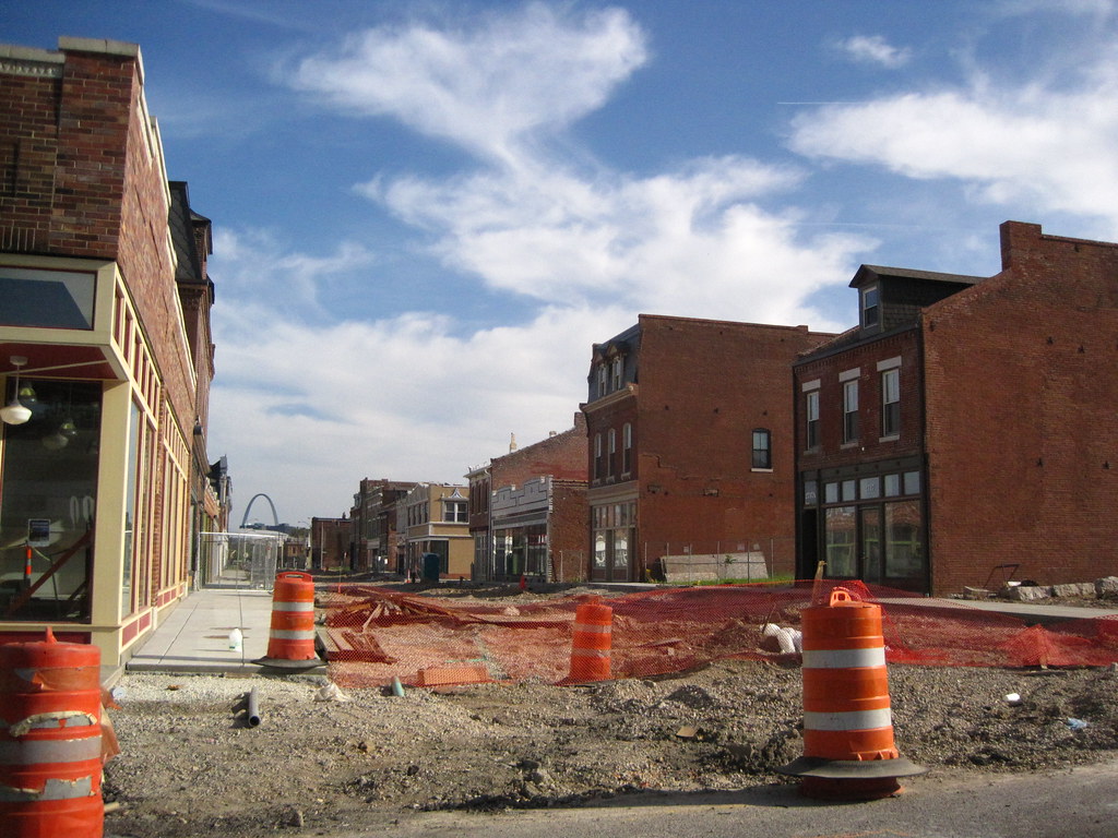
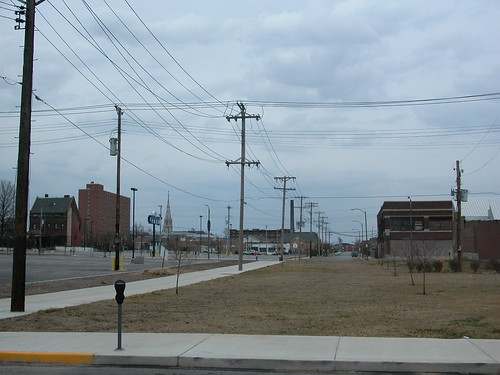
 Here's the current view from St. Louis Avenue looking south down the two commercial blocks of 14th Street that once composed the "14th Street Mall." Sidewalks nearly done: check. Street under construction: check. Reopening of 14th Street by the fall: check and double check.
Showing posts with label streets. Show all posts
Showing posts with label streets. Show all posts
Monday, April 19, 2010
14th Street Mall: Almost History
Here's the current view from St. Louis Avenue looking south down the two commercial blocks of 14th Street that once composed the "14th Street Mall." Sidewalks nearly done: check. Street under construction: check. Reopening of 14th Street by the fall: check and double check.


Sunday, April 18, 2010
16th Street: Open for Business
 Here is 16th Street looking south across Delmar Boulevard. This may seem a mundane site to serve as a subject for a short article, but it is noteworthy for one reason: the stupid gates that blocked 16th Street are gone. The gates have been gone for a few years now, but for a long time gates blocked the sidewalks and street here, cutting off through traffic of all kinds between Delmar and Dr. Martin Luther King Boulevard.
Residents of Carr Square couldn't pass through walking to downtown, downtown residents could not pass through walking north. Cars couldn't pass from Washington up to MLK or vice versa. Parking spots on this block were ridiculous on weekends, when they sat unused while City Museum patrons circles the block looking for spaces. Street grids are systems, and no disruption is casual to users. Like most closures in St. Louis, this closure had no apparent reason, other than to serve some whim of a tenant in one of the warehouses.
No doubt some well-meaning alderman put forth a bill to vacate the right-of way here, and no doubt that alderman was wrong to do so. Streets, sidewalks and alleys are public spaces that should be closed only in rare circumstances -- and business loading, parking and "security" are insufficient reasons to alter the flow of the life-blood of pedestrians and motorists across the city. Another alderman reversed the closure, and the life of the grid has returned.
If there's such a closure in your ward, call your alderman and get it taken out! Gates and blockades can be removed as easily as they are installed.
Wednesday, March 31, 2010
Street and Sidewalk Work Started on 14th Street
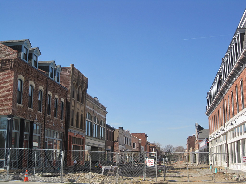
On Friday, after long-awaited approval from the Missouri Department of Transportation, street and sidewalk work began on the two blocks of 14th Street once known as the 14th Street Mall. Work should be completed by the fall. Building rehabilitation is nearly complete. Read more on What's New in Old North.
Saturday, December 26, 2009
Vintage Streetcar Photographs Show Mid-Century St. Louis
This week St. Louisan extraordinaire Jeff Vines discovered an online cache of 120 photographs of St. Louis Public Service Company trolley cars taken between 1954 and 1961. A few photographs from the 1980s are included.
The images of the cars in their vintage red, white and tan color scheme are fabulous. Yet the photographs also capture views of the city long lost, change or, in a few cases, preserved. The old Grand Avenue viaduct, its replacement soon to be replaced, features in many of the photographs in use adn under demolition. Other locations include the South Broadway car barn (now site of Carnahan Middle School), the Midtown skyline (remarkably unchanged), Maplewood, University City and Flynn Park, Washington Avenue from the Eads Bridge street car turn-around to 15th Street, rural Creve Couer, downtown St. Charles, and McKnight Road.
The photographs of the vicinity of the Eads Bridge and Washington Avenue include shots of the piers for the modern elevated lanes of I-70, now seen as likely to be removed in most of our life times.
The images of the cars in their vintage red, white and tan color scheme are fabulous. Yet the photographs also capture views of the city long lost, change or, in a few cases, preserved. The old Grand Avenue viaduct, its replacement soon to be replaced, features in many of the photographs in use adn under demolition. Other locations include the South Broadway car barn (now site of Carnahan Middle School), the Midtown skyline (remarkably unchanged), Maplewood, University City and Flynn Park, Washington Avenue from the Eads Bridge street car turn-around to 15th Street, rural Creve Couer, downtown St. Charles, and McKnight Road.
The photographs of the vicinity of the Eads Bridge and Washington Avenue include shots of the piers for the modern elevated lanes of I-70, now seen as likely to be removed in most of our life times.
Monday, December 7, 2009
Thoughts on the Proposed Adams Grove Infill Project
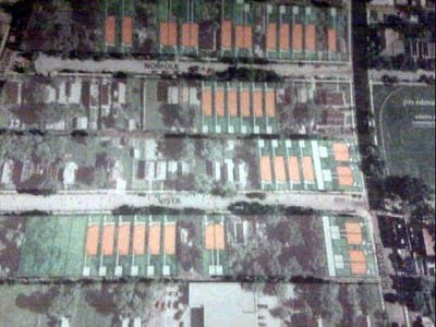
Alex Ihnen has reported the his St. Louis Urban Workshop blog that a substantial new scattered-site infill housing project is in the works for part of Forest Park Southeast. Specifically, the Regional Housing and Community Development Alliance hopes to build 40 new houses on and around Norfolk and Vista avenues west of Newstead. These are some the neighborhood's roughest blocks in its most neglected portion, the area south of Manchester Avenue known as Adams Grove. Adams Grove was platted in 1875 and is the oldest part of Forest Park Southeast, but long has lagged behind the northern section of the neighborhood in development efforts.
Readers may recall that in 2006, these blocks were targeted by the Forest Park Southeast Development Corporation during a wide round of demolition that took down over 30 buildings across the neighborhood. The Preservation Board approved demolition permits for one building on Norfolk and eight buildings on Vista.
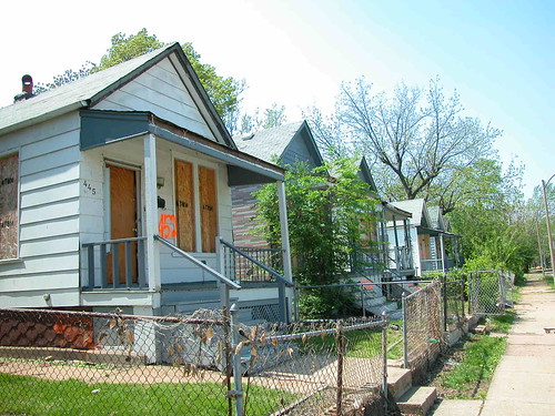
 One of the worst aspects of this round of demolition was the wholesale removal of vacant frame houses like the row shown here. These six houses stood from 4452-4462 Vista Avenue. Proponents of demolition argued that the houses were too small for people's demands, and that wide clearance would allow for a large-scale new housing effort.
While the large-scale infill project is welcome fulfillment of the promises that the Development Corporation made in support of demolition, there remains some bittersweet irony that the houses now proposed for construction are small, one-story homes like those rejected as unfit for housing needs. Make no mistake, though -- the size of the proposed infill is perfect for the area and the housing needs. That's why some of us opposed demolishing the frame shotgun houses that also could have served those needs.
The wide demolition in 2006 could lead to two other losses, one of which is the prominent two-story brick corner building at Newstead and Vista that recent was being rehabilitated. Getting remaining buildings listed in the National Register of Historic Places to attain historic rehab tax credits might be difficult, although certainly not impossible. The demolitions are tentative, though, and could be avoidable.
One problem for these specific block of Adams Grove are the cul-de-sac street closures on the western end. These closures are partly responsible for the decline of the building stock in this area. Placement of the closures at an unsightly and moribund stretch of Taylor Avenue has compounded the ill effects. The "dead ends" on Swan, Norfolk and Vista avenues attract enough criminal activity to deserve the term.
Here's the closure on Norfolk:

And this is Vista:

 The Vista closure even has large evergreen trees that close off the sight lines of the street. To make these blocks safe and desirable places to live, the closures must be removed and Taylor must be improved. I want very much for the infill project to succeed, because Adams Grove needs major development. That development must address the circulation problem to succeed.
Readers may recall that in 2006, these blocks were targeted by the Forest Park Southeast Development Corporation during a wide round of demolition that took down over 30 buildings across the neighborhood. The Preservation Board approved demolition permits for one building on Norfolk and eight buildings on Vista.
 One of the worst aspects of this round of demolition was the wholesale removal of vacant frame houses like the row shown here. These six houses stood from 4452-4462 Vista Avenue. Proponents of demolition argued that the houses were too small for people's demands, and that wide clearance would allow for a large-scale new housing effort.
While the large-scale infill project is welcome fulfillment of the promises that the Development Corporation made in support of demolition, there remains some bittersweet irony that the houses now proposed for construction are small, one-story homes like those rejected as unfit for housing needs. Make no mistake, though -- the size of the proposed infill is perfect for the area and the housing needs. That's why some of us opposed demolishing the frame shotgun houses that also could have served those needs.
The wide demolition in 2006 could lead to two other losses, one of which is the prominent two-story brick corner building at Newstead and Vista that recent was being rehabilitated. Getting remaining buildings listed in the National Register of Historic Places to attain historic rehab tax credits might be difficult, although certainly not impossible. The demolitions are tentative, though, and could be avoidable.
One problem for these specific block of Adams Grove are the cul-de-sac street closures on the western end. These closures are partly responsible for the decline of the building stock in this area. Placement of the closures at an unsightly and moribund stretch of Taylor Avenue has compounded the ill effects. The "dead ends" on Swan, Norfolk and Vista avenues attract enough criminal activity to deserve the term.
Here's the closure on Norfolk:
And this is Vista:
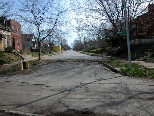
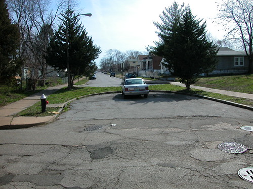 The Vista closure even has large evergreen trees that close off the sight lines of the street. To make these blocks safe and desirable places to live, the closures must be removed and Taylor must be improved. I want very much for the infill project to succeed, because Adams Grove needs major development. That development must address the circulation problem to succeed.
Thursday, November 19, 2009
Reconnection in Old North, and a Suggestion for McEagle
 Days that came, years again
Came in here once again
-- John Cale, "Big White Cloud"
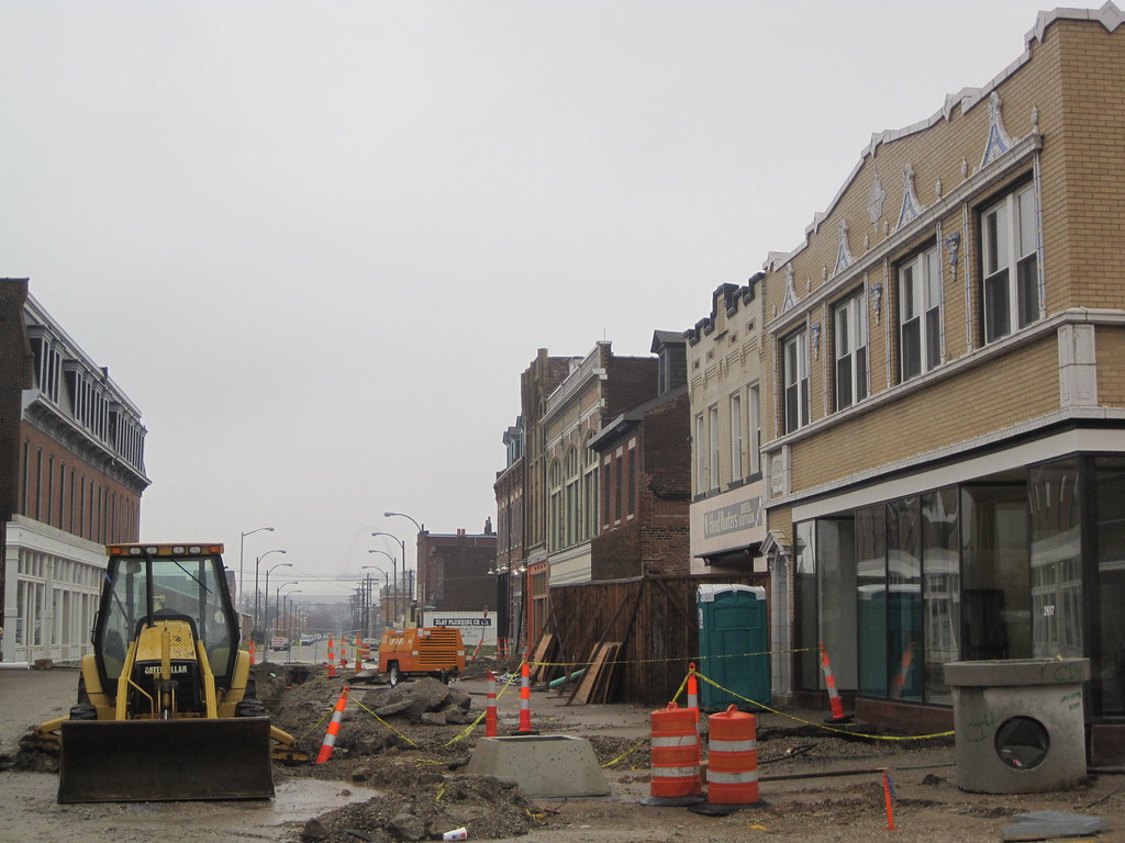
One of the highlights of this gloomy week has been a look at one of the north side's biggest development stories: the removal of the failed pedestrian mall on 14th Street in Old North. As part of the $35 million Crown Square project, the city has removed the street closures and is working on reconstructing both the two closed blocks of 14th Street between St. Louis Avenue and Warren Street and the two closed blocks of Montgomery Street between Blair Avenue and 13th Street. While work on the 27 historic buildings being rehabilitated has been underway since September 2007 and is nearing completion, delays forced the actual street work to this fall. The streets should be reopened in the spring.
Already the removal of the mall's pavement, trees and light posts has opened views around the now-rehabilitated historic buildings. The sense of connection to the surrounding neighborhood slowly lost after the pedestrian mall opened in 1977 has returned. All that awaits are actual sidewalks, street lights and the centerpiece street.

People are already there. Headhunters Salon has remained open on the mall during construction, and Peter Sparks has been working on his building at the northwest corner of Montgomery and 14th. Sparks envisions a gallery and art studios. More recently, residents have moved into many of the units in the buildings on 14th Street. For now, they enter through rear entrances. In the future, the residents will be able to walk up and down 14th Street.
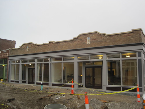 One of the first storefront spaces to be occupied is the new office of the Old North St. Louis Restoration Group at 2700 N. 14th Street. Built in 1925, the one-story commercial building had been robbed of its shaped parapet and clad in enamel panels in 1955. Through design by Rosemann Associates and historic research by Matt Bivens of the Regional Housing and Community Development Alliance (RHCDA), the building has been returned to historic appearance. Inside is both the office of the Restoration group and a large community exhibit and meeting space, shown below.
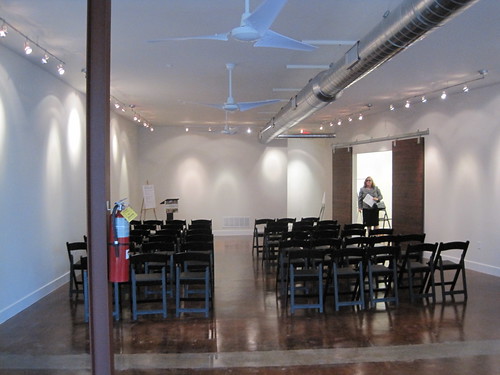 The office features sliding doors made of slavaged floor boards and a reception desk made of timbers that once were part of the floor system in the building.
 The view from that desk shows the fruits of the organization's hard work. The Restoration Group is a development partner with RHCDA in Crown Square. The community development corporation spent over a decade trying to spur redevelopment of the pedestrian mall area. Now that the redevelopment is almost done, the organization appropriately has moved into a new space in the heart of the project and at the center of the neighborhood. Once the street reopens, the office will be easy to find. Large windows provide a visual connection to neighborhood.
Another north side development story this week involved the formal announcement of a redevelopment agreement for the Northside Regeneration project. That project's developer, McEagle Properties, has a long way to go before it completes its first $35 million is actual redevelopment. Meanwhile, McEagle needs the support and good will of the north side residents and businesspeople its project aims to serve. Why not open a field office like the new Old North St. Louis Restoration Group office? McEagle's physical presence has been limited to vacant buildings, orange construction fencing and hired lawn mowing crews. That's quite a contrast to a pleasant office and community space with big storefront windows, a friendly staff and a welcome mat. Presence in the community doesn't happen at press conferences, on Twitter or through fancy websites -- it happens on the street, where eveyone can find it.
Monday, September 7, 2009
Progress on 14th Street
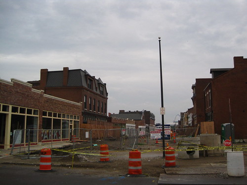 The mall is dead! Crews finally have removed all of the raised pedestrian mall on 14th Street in Old North. Work is underway on reconstructing the streets and sidewalks that will connect the neighborhood to the rehabbed buildings in the two-block stretch between St. Louis and Warren avenues.
 One block north of the former mall, the Urban Studio Cafe opened last week at 2815 N. 14th Street next door to Crown Candy Kitchen. The cafe offers coffee, pastries and (starting tomorrow) lunch items.
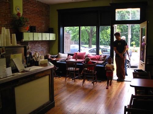 The Urban Studio Cafe is open from 8 a.m. until 2 p.m. daily. What a huge difference it makes for Old North to have a spot for residents to gather and hang out away from home! This is the type of "commercial development" that the north side needs most -- development that builds up the social capital of neighborhoods.
Sunday, August 30, 2009
Making a Difference on the Riverfront
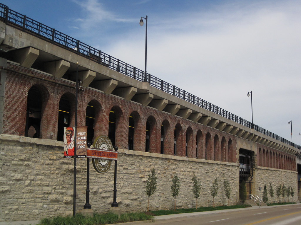
The southern flank of the mighty Eads Bridge has received a major landscape upgrade, due to the efforts of Metro, the Jefferson National Expansion Memorial and the Laclede's Landing Redevelopment Corporation. That is to say, the strip between the bridge approach and Washington Avenue actually now is landscaped! The difference between the formerly part-mulch, part-dirt terrain and the new verdant tree-planted, grassy, flowery setting could not be more stark.
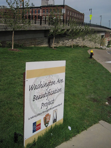 For years, this area was a disgraceful disarray in an area marred by many such urban design problems, including the intrusive elevated section of I-70, the parking garage barrier on the northern edge of the Memorial and the lackluster riverfront itself. The "Washington Avenue Beautification Project" does not resolve these larger issues, but vanquishes the terrible appearance of a very-visible area. Pedestrians on the Eads Bridge can now look out at the Gateway Arch and grounds, and look down and see an extension of that inviting park setting.
I do have a quibble with the project concerning the lack of sidewalk on most of this side of Washington. (The other side of the street has a continuous sidewalk.) The photograph on the left shows the sidewalk running east from Second Street to First Street, while that on the right shows the strip running west.
 |  |
Addition of metered parking here -- something that Metro, operator of the garage, would likely oppose -- would be desirable. Meters would relieve parking problems on the Landing and calm traffic. However, a continuous sidewalk would be needed. Perhaps this issue can be explored in any design competition that the National Park Service (NPS) undertakes for the Memorial. NPS' draft general management plan for the Memorial identifies the parking garage site as potentially worth repurposing, so this corridor could be transformed at some point.
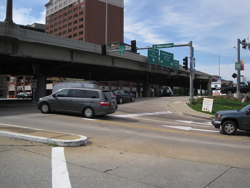 Of course, the sidewalk would lead westward walkers out into the morass of the Eads Bridge/Memorial Drive/Washington Avenue intersection. This intersection may be the most confusing in the city! Hopefully any design competition will lead to resolution of this problem, which plagues one of the Memorial's key entry points. Removal of the interstate is the most direct way to clarify traffic issues here, but that removal is probably on a slower track than the design competition timeline. Who knows? Perhaps the design competition will be the impetus for grad civic thinking on urban design, and our political leaders will embrace a visionary change downtown like those who laid out the Memorial did so long ago.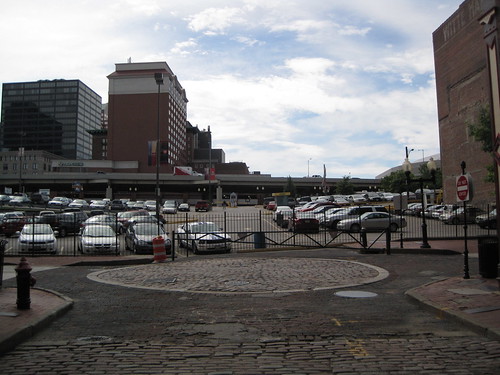
For now, the most-traveled pedestrian path between downtown and the Landing is right here. Can't see the path? Well, look carefully. There is a gate-sized opening in the fence of this parking lot on Second Street. People walk back and forth across this lot all day long, because it remains the most direct link between the Landing and downtown. It does not require much imagination to recognize that there is a major connectivity issue here. A sidewalk on Washington would have helped, although the larger disconnect between the riverfront and downtown remains the big problem.
The Washington Avenue Beautification Project points the way to a realistic way to implement changes to the riverfront that will add up to transformative action. While we need visionary leadership on the riverfront design challenge, we also need resolution of glaring quality of experience problems whose resolution is obvious. This space on Washington needed landscaping, and now it is landscaped. Laclede's Landing needs a better pedestrian connection to downtown. Perhaps a sidewalk on the north side of Washington is the way to go -- narrow the street, build a sidewalk along the new plantings. Perhaps the path already being used could be formalized through reconstruction of Lucas Avenue west through the parking lot. Let's follow one change with another and keep the momentum rolling.
Monday, March 30, 2009
Memorial Boulevard
Yesterday evening I happened to be driving south on I-70 through downtown St. Louis. Often this drive passes by and barely registers in my mind, but this time I could not help but vividly see something -- something that was not there. As I rode the elevated lanes that divide and conquer the area between downtown and the riverfront, I looked south at the point where 4th Street comes close to I-70. There, the highway and the street form a wedge shape filled by overabundant sidewalk space, a parking lot and the Hampton Inn.

I imagined that instead of being elevated ahead of a descent, I was driving at grade from Cass Avenue all of the way to the Poplar Street Bridge. The highway became an urban thoroughfare allowing for easy local access and great views. I could foresee stopping at traffic lights as pedestrians walked from the casino over to restaurants on Washington Avenue, or from downtown apartments to the river for a stroll. Instead of a gravel lot, I saw a completed Bottle District with modern mid-rise residential buildings. Lumiere Place presented an attractive face to downtown.
Straight ahead, I did not see the weary concrete sidewalks and parking lot ahead of the Hampton Inn, but a new flatiron office building with a fountain in the middle of the plaza where traffic between the boulevard merged with Fourth Street. The sensation was akin to the view of downtown Chicago offered at the point near the Drake Hotel where Lake Shore Drive meets the north end of Michigan Avenue. That view always gives me a giddy feeling, because the essence of the entire urban density of Chicago seems to come into view there. The options there are staying on Lake Shore Drive for the breathtaking view of the lake or turning off onto the Magnificent Mile. There is no mediocrity in sight.
Yesterday, I saw a similar picture. I could make a right turn and veer off into the excitement of downtown, lured by the refined architecture of the Missouri Athletic Club, or head straight for that section of downtown that is right at the Gateway Arch. Either way I was going to see our urban core at its best. When I was right at the Arch, instead of dangerously looking up through aging concrete infrastructure, I caught a red light and had at least 20 seconds to take in the glistening sheen of the Arch skin reflecting the golden sunset.

I imagined that instead of being elevated ahead of a descent, I was driving at grade from Cass Avenue all of the way to the Poplar Street Bridge. The highway became an urban thoroughfare allowing for easy local access and great views. I could foresee stopping at traffic lights as pedestrians walked from the casino over to restaurants on Washington Avenue, or from downtown apartments to the river for a stroll. Instead of a gravel lot, I saw a completed Bottle District with modern mid-rise residential buildings. Lumiere Place presented an attractive face to downtown.
Straight ahead, I did not see the weary concrete sidewalks and parking lot ahead of the Hampton Inn, but a new flatiron office building with a fountain in the middle of the plaza where traffic between the boulevard merged with Fourth Street. The sensation was akin to the view of downtown Chicago offered at the point near the Drake Hotel where Lake Shore Drive meets the north end of Michigan Avenue. That view always gives me a giddy feeling, because the essence of the entire urban density of Chicago seems to come into view there. The options there are staying on Lake Shore Drive for the breathtaking view of the lake or turning off onto the Magnificent Mile. There is no mediocrity in sight.
Yesterday, I saw a similar picture. I could make a right turn and veer off into the excitement of downtown, lured by the refined architecture of the Missouri Athletic Club, or head straight for that section of downtown that is right at the Gateway Arch. Either way I was going to see our urban core at its best. When I was right at the Arch, instead of dangerously looking up through aging concrete infrastructure, I caught a red light and had at least 20 seconds to take in the glistening sheen of the Arch skin reflecting the golden sunset.
Wednesday, March 11, 2009
Dead Zone
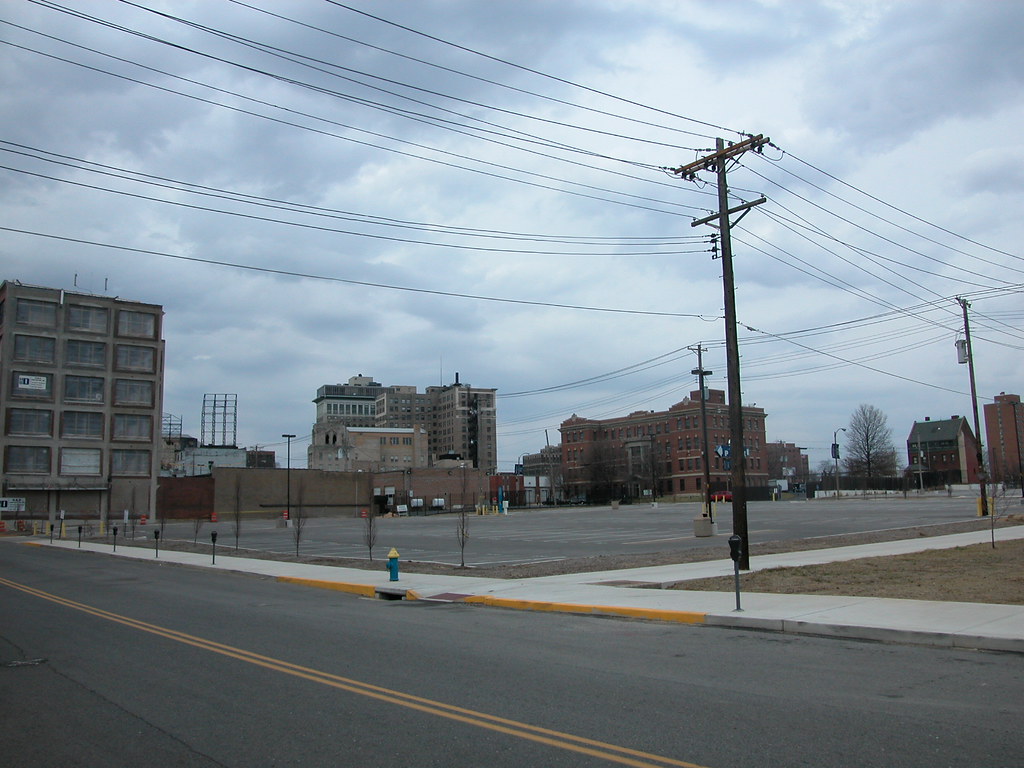 Over the weekend, I had the opportunity to spend some time at the site on Locust Street where the livery stable demolished by St. Louis University in 2007 once stood. The site would be located at the northwest corner of Locust and Josephine Baker Avenue, except that the university requested that Josephine Baker be removed.
The occasion was the filming of This Was the Future, a short documentary on the efforts to save the DeVille Motor Hotel (more on that film later). For the film, interview subjects were invited to select a site where a historic building once stood that is now an empty hole in a vibrant area. While it is hard to choose from some of the harsh empty lots we have in this city, I settled on what has to be one of the worst urban planning disasters in recent years.
 The two-story livery stable building was a bridge between the emergent renewal in the Locust Street Business District and the more established revitalization of Grand Center. Grand Center's motto is "the intersection of art and life," an acknowledgment of the power of crossroads. Here stood a building that was a crossroads, and now we have an asphalt chasm, and not even a literal crossroads since one of the two streets here is now gone.
Even as a warehouse, the livery stable exuded more life than the parking lot on a busy night. On a Saturday afternoon, not a single car was parked on the lot, and few were parked at nearby meters. Clearly, the lot is there for special events. However, trading the potential of daily urban activity in a rehabilitated building for the occasional overuse of a parking lot makes no sense in a central city location. Not at all.
The side effect of the livery stable debacle is the spatial segregation (through building density) of Grand Center from the emergent area on Locust and of Renaissance Place (through removal of Josephine Baker) from St. Louis University and Locust Street. Human-scale urban renewal has finally come to Midtown on Locust Street and at Renaissance Place, and a potential connection between those successes is lost, and replaced with a land use that not only divides but is totally alien to the surrounding urban fabric. We could have done so much better.
Friday, January 16, 2009
MLK Clean Up
From State Senator Jeff Smith:
Closer to home, I'm organizing our second annual Martin Luther King, Jr., Day Cleanup of MLK Jr. Blvd in the city, on Monday, Jan. 19 - the state holiday honoring the civil rights leader. This is a great opportunity to honor the life and memory of Dr. King, and last year, (in spite of the weather), we had a great time doing it. I invite any of you, along with your friends, friends, neighbors and any organizations to which you belong, to meet at the corner of MLK Jr. Boulevard and Union at 12 p.m. on Monday. Gloves, trash bags, donuts, and hot chocolate will be provided!
If you can make it, just call my district aide Johnny Little at (314) 601-4252, or reply to this email (jeff.smith.reply@gmail.com).
Closer to home, I'm organizing our second annual Martin Luther King, Jr., Day Cleanup of MLK Jr. Blvd in the city, on Monday, Jan. 19 - the state holiday honoring the civil rights leader. This is a great opportunity to honor the life and memory of Dr. King, and last year, (in spite of the weather), we had a great time doing it. I invite any of you, along with your friends, friends, neighbors and any organizations to which you belong, to meet at the corner of MLK Jr. Boulevard and Union at 12 p.m. on Monday. Gloves, trash bags, donuts, and hot chocolate will be provided!
If you can make it, just call my district aide Johnny Little at (314) 601-4252, or reply to this email (jeff.smith.reply@gmail.com).
Pointless Change at Grand and Chouteau
At last night's candidate forum sponsored by the 15th Ward Democrats, Comptroller Darlene Green received applause for an issue not directly related to her campaign. When asked about red light cameras, she said that she definitely knew of a camera that needs to be removed: the red light camera at Grand and Chouteau. Mayor Francis Slay arrived during this time, so Green directly addressed the mayor from the podium.
The problem with the light, Green said, is that it is part of changes to the intersection that forces the three lanes of southbound traffic on Grand into two with a left-turn-only lane at Chouteau. Past Chouteau, the road is back to three lanes. Rarely do left turns clog the southbound lanes, and there are always vehicles in the inside lane that have to move over at the last minute to avoid getting a camera ticket from running straight in a turn-only lane.
The audience burst into applause, for good reason. That intersection reconfiguring is one of the silliest in the city. Before the camera went up, I joined many drivers in ignoring the changes. Since I am not an alderman, getting a red light ticket fixed might be difficult, so I now reluctantly obey the pointless changes there.
All of the red light cameras violate the spirit of the Fourth Amendment to the U.S. Constitution and any sensible view of law enforcement. I hope that Comptroller Green's recommendation is followed, but we need to pull them out completely. The changes at Grand and Chouteau are blatantly revenue-driven, and impede smart traffic flow there. They need to be undone. Then we need to get rid of the remaining red light cameras and find a more dignified, constitutional way of enhancing city revenue.
The problem with the light, Green said, is that it is part of changes to the intersection that forces the three lanes of southbound traffic on Grand into two with a left-turn-only lane at Chouteau. Past Chouteau, the road is back to three lanes. Rarely do left turns clog the southbound lanes, and there are always vehicles in the inside lane that have to move over at the last minute to avoid getting a camera ticket from running straight in a turn-only lane.
The audience burst into applause, for good reason. That intersection reconfiguring is one of the silliest in the city. Before the camera went up, I joined many drivers in ignoring the changes. Since I am not an alderman, getting a red light ticket fixed might be difficult, so I now reluctantly obey the pointless changes there.
All of the red light cameras violate the spirit of the Fourth Amendment to the U.S. Constitution and any sensible view of law enforcement. I hope that Comptroller Green's recommendation is followed, but we need to pull them out completely. The changes at Grand and Chouteau are blatantly revenue-driven, and impede smart traffic flow there. They need to be undone. Then we need to get rid of the remaining red light cameras and find a more dignified, constitutional way of enhancing city revenue.
Tuesday, December 30, 2008
St. Louis Area Makes a List for Obama Administration
An article in the December 26 edition of the St. Louis Business Journal reported that the City of St. Louis has created a 400-page report on its federal infrastructure funding priorities, while St. Louis County has created a 200-page document of the same. The governments will deliver these reports to the incoming presidential administration of Barack Obama in response to his promise to channel federal dollars into public works programs across the nation.
The city's report outlines some big-ticket priorities: $900 million for the North/South MetroLink line, $219.5 million in streetscape improvements, $160 million in public school building improvements, $80 million in airport improvements and $59 million to implement the Gateway Mall Master Plan. According to Deputy Mayor Barbara Geisman, all of these projects are ready to start as soon as they are funded, but full funding is unlikely immediately. Still, the city's placement of MetroLink expansion at the top of its list is smart, since that is a crucial component of building a strong city economy and connecting citizens to jobs. The city's list carries some basic but crucial needs: street and transportation improvements and school renovation. (The Gateway Mall project is another story, but something does need to happen to the mall area.) These are important to stabilizing our neighborhoods, and Geisman should be commended for placing a high priority on these things.
Moving beyond the ready-to-go ideas, perhaps the city would consider a future request for an urban homesteading program. The program could find funding to stabilize and market the Land Reutiliation Authority's thousands of vacant homes across the city, generating hundreds of construction jobs and getting tax-free property back on city tax rolls where it can generate money to fund roads and schools.
St. Louis County's list starts with a $200 million, 3.3-mile expansion on Highway 141 at the top followed by the $105 million needed to retain existing Metro public transportation in the outer county. A significant and less costly item on the St. Louis County list is $24 million to fund a Midwest China Trade and Commercialization Center at NorthPark. While the China cargo hub prospect is not a done deal, it has the potential to bring more jobs to the St. Louis area in the next decade than any other prospect.
Other requests headed to the Obama administration are a predictable $510 million highway spending request from the Missouri Department of Transportation and a $66 million request to extend Page Avenue farther into St. Charles County, so that one may have a straight drive from downtown St. Louis to Mid Rivers Mall Drive. These requests are the usual pave-it-and-they-will-come junk.
Obviously, the disparate requests show the problem of regional political fragmentation. Inevitably, there will be partial funding of many requests rather than full funding of something big and transformational. Imagine what might happen if the regional governments pulled together with one request for the North/South MetroLink line this year, and further extensions in the future, rather than place the burden solely on the City of St. Louis. Imagine if the Missouri Department of Transportation put some of the needed Metro funding in its request.
Remember when we imagined that Obama could become president? Now that the dream is real, it's time to imagine other changes closer to home. Or, we can all fight over the pie for the next eight years, but it doesn't take much imagination to guess where that will get the St. Louis area.
The city's report outlines some big-ticket priorities: $900 million for the North/South MetroLink line, $219.5 million in streetscape improvements, $160 million in public school building improvements, $80 million in airport improvements and $59 million to implement the Gateway Mall Master Plan. According to Deputy Mayor Barbara Geisman, all of these projects are ready to start as soon as they are funded, but full funding is unlikely immediately. Still, the city's placement of MetroLink expansion at the top of its list is smart, since that is a crucial component of building a strong city economy and connecting citizens to jobs. The city's list carries some basic but crucial needs: street and transportation improvements and school renovation. (The Gateway Mall project is another story, but something does need to happen to the mall area.) These are important to stabilizing our neighborhoods, and Geisman should be commended for placing a high priority on these things.
Moving beyond the ready-to-go ideas, perhaps the city would consider a future request for an urban homesteading program. The program could find funding to stabilize and market the Land Reutiliation Authority's thousands of vacant homes across the city, generating hundreds of construction jobs and getting tax-free property back on city tax rolls where it can generate money to fund roads and schools.
St. Louis County's list starts with a $200 million, 3.3-mile expansion on Highway 141 at the top followed by the $105 million needed to retain existing Metro public transportation in the outer county. A significant and less costly item on the St. Louis County list is $24 million to fund a Midwest China Trade and Commercialization Center at NorthPark. While the China cargo hub prospect is not a done deal, it has the potential to bring more jobs to the St. Louis area in the next decade than any other prospect.
Other requests headed to the Obama administration are a predictable $510 million highway spending request from the Missouri Department of Transportation and a $66 million request to extend Page Avenue farther into St. Charles County, so that one may have a straight drive from downtown St. Louis to Mid Rivers Mall Drive. These requests are the usual pave-it-and-they-will-come junk.
Obviously, the disparate requests show the problem of regional political fragmentation. Inevitably, there will be partial funding of many requests rather than full funding of something big and transformational. Imagine what might happen if the regional governments pulled together with one request for the North/South MetroLink line this year, and further extensions in the future, rather than place the burden solely on the City of St. Louis. Imagine if the Missouri Department of Transportation put some of the needed Metro funding in its request.
Remember when we imagined that Obama could become president? Now that the dream is real, it's time to imagine other changes closer to home. Or, we can all fight over the pie for the next eight years, but it doesn't take much imagination to guess where that will get the St. Louis area.
Thursday, October 30, 2008
Locust Street Canyon
 The view east from 11th Street of Locust Street in downtown St. Louis is encouraging. The differentiation of building heights, materials and styles gives the scene a truly urban complexity. Changes are in store as the Roberts Brothers prepare to rehabilitate two buildings (913 & 917 Locust) and demolish two buildings (921 & 923 Locust) in this scene. On the site of the demolished buildings will rise an addition to 917 Locust that will be part of a Hotel Indigo. How will their new building fit in this scene?
Thursday, October 2, 2008
The Greening of Memorial Drive
I count on my readers' intake of other blogs on the same subjects that I cover, which is why I rarely link directly to the excellent posts made by other local urbanist bloggers.
Still, sometimes a post elsewhere is so intriguing that I just want everyone in the world to read it. Rick Bonasch's post "Yin, Meet Yang" today on STL Rising is one of those. In June, Rick introduced a plan for reworking Memorial Drive that is daring, bold and intelligent -- take out the depressed and raised sections of I-70 and Memorial Drive, and put in an at-grade parkway that is both friendly to pedestrians and inspiring to drivers who get a great view of the Gateway Arch. This idea trumps the "lid" plan that offers little change to the ugly mess of roadways that detract from the Arch grounds' western edge and prevent real access between downtown and the grounds. The "lid" is showy but also expensive, ineffective and unsustainable. For less money we could have a real urban design solution; for more, we can have a band-aid that covers about ten percent of a big wound.
Today, Rick offers a new reason why the idea of reworking Memorial Drive is a good one -- it can be very green.
Still, sometimes a post elsewhere is so intriguing that I just want everyone in the world to read it. Rick Bonasch's post "Yin, Meet Yang" today on STL Rising is one of those. In June, Rick introduced a plan for reworking Memorial Drive that is daring, bold and intelligent -- take out the depressed and raised sections of I-70 and Memorial Drive, and put in an at-grade parkway that is both friendly to pedestrians and inspiring to drivers who get a great view of the Gateway Arch. This idea trumps the "lid" plan that offers little change to the ugly mess of roadways that detract from the Arch grounds' western edge and prevent real access between downtown and the grounds. The "lid" is showy but also expensive, ineffective and unsustainable. For less money we could have a real urban design solution; for more, we can have a band-aid that covers about ten percent of a big wound.
Today, Rick offers a new reason why the idea of reworking Memorial Drive is a good one -- it can be very green.
Sunday, August 17, 2008
Moonlight Ramble Included the Mullanphy Emigrant Home
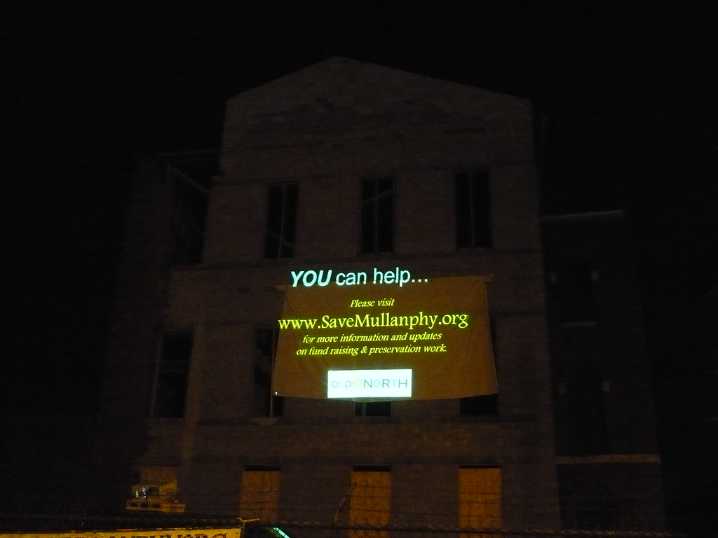
Early Sunday morning, cyclists on this year's Moonlight Ramble made a north turn to ride by the historic Mullanphy Emigrant Home in Old North St. Louis. The Ramble, organized each year since 1964 by the Gateway Council of Hostelling International USA, is a midnight bike ride held on the Saturday night nearest the full moon in August. Over 15,000 riders participated this year, and each one got to see first-hand what could be an exciting new home for Hostelling International's local chapter.
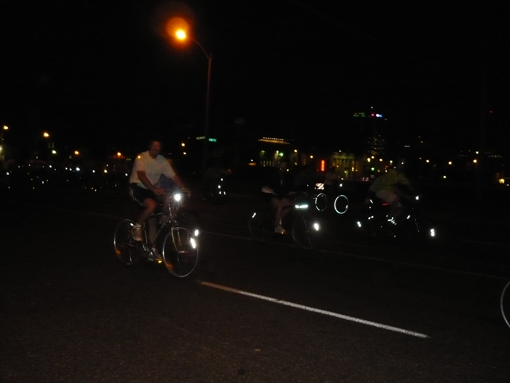 While the route of the ride was a secret, word had already spread that this year's ride proceeds would benefit the Mullanphy Emigrant Home, envisioned as a world-class hostel by the Gateway Council. Hostelling International hopes to continue rehabilitation of the Emigrant Home, hit by devastating storms in 2006 and 2007 and now largely stabilized through the efforts of the Old North St. Louis Restoration Group.
The hostel plan would both restore the historic architecture of a building built in 1867 from plans by renowned architects George Barnett and Alfred Piquenard and also rededicate the building to housing the itinerant. The Emigrant Home originally housed immigrants headed westward through St. Louis from New York and other eastern ports. Hosteling International would provide lodging for a different sort of migrant -- travelers exploring the United States. If the hostel opens it would be a serendipitous revival of the building's original purpose.
 Meanwhile, residents of Old North are enthusiastic about the prospects for the building's future, and the legions of travelers who might come through their neighborhood as they travel this country. That enthusiasm was on display in full force last night, and a throng of neighbors (including people from the block facing the Emigrant home) welcomed thousands of riders for well over an hour. To learn more about the Mullanphy Emigrant Home, visit SaveMullanphy.org.
All photographs by Lynn Josse.
Thursday, July 10, 2008
Time to Revise Memorial Drive
In my latest commentary for KWMU, I join what is becoming a bandwagon call: "Time to Revise Memorial Drive".
Kudos to Rick Bonasch, whose STL Rising blog post "The Case for a New Memorial Drive" served as my inspiration.
Kudos to Rick Bonasch, whose STL Rising blog post "The Case for a New Memorial Drive" served as my inspiration.
Thursday, May 1, 2008
STOP
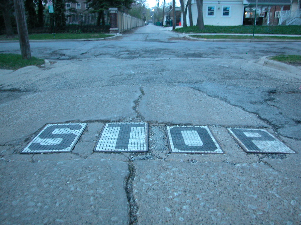
This neat feature alerts drivers in an alley headed north toward Ontario Street between Linden and Euclid avenues in Oak Park, Illinois. Embedded tiles form a sturdy, enduring stop sign.
Saturday, March 8, 2008
Time is Right for Making Changes to New Mississippi River Bridge
On February 28, outgoing Missouri Governor Matt Blunt announced that Illinois and Missouri had reached a final agreement for construction of the new Mississippi River Bridge. While actual construction remains a few years away, the agreement brings back to the forefront concerns about the bridge's impact on the urban fabric of north St. Louis.
While officials long ago shelved a highly destructive initial bridge concept that included a local traffic connector from the bridge to 14th street, the current plan leaves much to be desired. There are many problems
Clearance. The bridge plan still entails clearance of historic buildings and existing business. While the path of the bridge itself is actually one of the least invasive paths possible, the affiliated roadway projects will entail demolition of dozens of buildings. Particularly troubling is the plan to wipe out all of the buildings remaining on the east side of 10th Street north of Hempstead Street. There are many occupied buildings and houses in that stretch. Most important, the part of Old North St. Louis east of I-70 is integral to connecting Old North to the emerging North Broadway corridor.
Bridge planners are more concerned with traffic efficiency than creating infrastructure that respects settlement patterns. While I-70 has some maddening issues related to placing exit ramps in odd spots due to existing buildings, those issues are small concessions to reality. Reality is that cities are what bind people together, and highways are but a means to that bind. Reconfiguring the St. Louis Avenue interchange is economically profligate; the plan entails spending millions on a road project with no economic return. Reconnecting Old North and North Broadway will cost less and maintain an existing building stock with the potential for high real estate values.
A corollary is that the presence of highway noise and pollution lowers real estate values. Why on earth political leaders would want to champion anything that lowers real estate values amid a recession is beyond my comprehension.
Connectivity. The plan still entails closure of north-south streets like 10th Street. Northside residents use these streets to get downtown. Closing the connections will stall pedestrians and add time to drivers' commutes. Closing the connections could isolate Old North from downtown. There is natural synergy between Old North and downtown, but there are physical impediments caused by a belt of vacant land, industrial uses and monolithic public housing complexes. The bridge exploits that belt, and tightens it.
Short-Sightedness. The new bridge does not address the terrible congestion caused by the poor configuration of ramps on the Poplar Street Bridge. Would the bridge even be needed if the Poplar Street's problems were fixed? No.
The bridge plan does not include any allowance for public transit. There is no space on the bridge for a street car line. That's going to seem silly in 25 years when our automobile lifestyle will be in crisis. Oh, well -- at least we can still walk across the bridge then.
Avoidance. The bridge path funnels I-70 traffic out of East St. Louis and away from downtown St. Louis. This path is a boon to people wanting to live in far-off Illinois suburbs like Highland but work in St. Louis or St. Charles counties. Sure, long-distance traffic will be well-served by a new bridge, but so will exurb-to-exurb commuters.
The bridge itself seems every bit a done deal. But are the details cast in concrete? No. There is still space to mitigate the bridge's impact on the urban fabric of the near north side. Since almost every change for the better involves reducing the project cost, changes are not only logical but prudent. In the wake of the agreement, it's time to make the best of the bridge.
While officials long ago shelved a highly destructive initial bridge concept that included a local traffic connector from the bridge to 14th street, the current plan leaves much to be desired. There are many problems
Clearance. The bridge plan still entails clearance of historic buildings and existing business. While the path of the bridge itself is actually one of the least invasive paths possible, the affiliated roadway projects will entail demolition of dozens of buildings. Particularly troubling is the plan to wipe out all of the buildings remaining on the east side of 10th Street north of Hempstead Street. There are many occupied buildings and houses in that stretch. Most important, the part of Old North St. Louis east of I-70 is integral to connecting Old North to the emerging North Broadway corridor.
Bridge planners are more concerned with traffic efficiency than creating infrastructure that respects settlement patterns. While I-70 has some maddening issues related to placing exit ramps in odd spots due to existing buildings, those issues are small concessions to reality. Reality is that cities are what bind people together, and highways are but a means to that bind. Reconfiguring the St. Louis Avenue interchange is economically profligate; the plan entails spending millions on a road project with no economic return. Reconnecting Old North and North Broadway will cost less and maintain an existing building stock with the potential for high real estate values.
A corollary is that the presence of highway noise and pollution lowers real estate values. Why on earth political leaders would want to champion anything that lowers real estate values amid a recession is beyond my comprehension.
Connectivity. The plan still entails closure of north-south streets like 10th Street. Northside residents use these streets to get downtown. Closing the connections will stall pedestrians and add time to drivers' commutes. Closing the connections could isolate Old North from downtown. There is natural synergy between Old North and downtown, but there are physical impediments caused by a belt of vacant land, industrial uses and monolithic public housing complexes. The bridge exploits that belt, and tightens it.
Short-Sightedness. The new bridge does not address the terrible congestion caused by the poor configuration of ramps on the Poplar Street Bridge. Would the bridge even be needed if the Poplar Street's problems were fixed? No.
The bridge plan does not include any allowance for public transit. There is no space on the bridge for a street car line. That's going to seem silly in 25 years when our automobile lifestyle will be in crisis. Oh, well -- at least we can still walk across the bridge then.
Avoidance. The bridge path funnels I-70 traffic out of East St. Louis and away from downtown St. Louis. This path is a boon to people wanting to live in far-off Illinois suburbs like Highland but work in St. Louis or St. Charles counties. Sure, long-distance traffic will be well-served by a new bridge, but so will exurb-to-exurb commuters.
The bridge itself seems every bit a done deal. But are the details cast in concrete? No. There is still space to mitigate the bridge's impact on the urban fabric of the near north side. Since almost every change for the better involves reducing the project cost, changes are not only logical but prudent. In the wake of the agreement, it's time to make the best of the bridge.
Friday, October 12, 2007
Hemmed In
A resident of north St. Louis is heading south to see a friend. He drives south on Florissant Avenue but then remembers that the section of Florissant/13th/Tucker over the old Illinois Termianl Railroad tunnel is closed indefinitely. So he makes a left turn on Cass Avenue, figuring that he can useBroadway to head south and bypass downtown. oops! The bridge over I-70 is closed indefinitely. So he turns around, heads west on Cass and then south on Jefferson. That is fine until he passes I-64. Jefferson is closed.
In the kind of city where north-south connectivity is easy, this driver would not be having so much trouble. But in a city with fewer than a half-dozen north-south streets that actually connect downtown to the city south of it, he's in a bind due to some coincidental road repairs.
There is definitely a spatial dimension to our city's polarization between north and south. I sure hope that Richard Baron is thinking about this fact as he contemplates Chouteau Lake.
In the kind of city where north-south connectivity is easy, this driver would not be having so much trouble. But in a city with fewer than a half-dozen north-south streets that actually connect downtown to the city south of it, he's in a bind due to some coincidental road repairs.
There is definitely a spatial dimension to our city's polarization between north and south. I sure hope that Richard Baron is thinking about this fact as he contemplates Chouteau Lake.
Subscribe to:
Posts (Atom)


 Posts
Posts

